

Heiligenstadt_St.AndräWördner_Donauroute_2016
A cycling route starting in Wördern, Lower Austria, Austria.
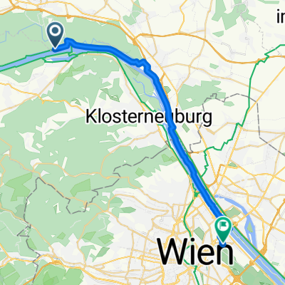
Overview
About this route
- -:--
- Duration
- 22.5 km
- Distance
- 79 m
- Ascent
- 88 m
- Descent
- ---
- Avg. speed
- ---
- Max. altitude
Route quality
Waytypes & surfaces along the route
Waytypes
Quiet road
9.4 km
(42 %)
Cycleway
8.3 km
(37 %)
Surfaces
Paved
19.1 km
(85 %)
Unpaved
2.5 km
(11 %)
Asphalt
18.9 km
(84 %)
Gravel
1.6 km
(7 %)
Continue with Bikemap
Use, edit, or download this cycling route
You would like to ride Heiligenstadt_St.AndräWördner_Donauroute_2016 or customize it for your own trip? Here is what you can do with this Bikemap route:
Free features
- Save this route as favorite or in collections
- Copy & plan your own version of this route
- Sync your route with Garmin or Wahoo
Premium features
Free trial for 3 days, or one-time payment. More about Bikemap Premium.
- Navigate this route on iOS & Android
- Export a GPX / KML file of this route
- Create your custom printout (try it for free)
- Download this route for offline navigation
Discover more Premium features.
Get Bikemap PremiumFrom our community
Other popular routes starting in Wördern
 Redlingerhütte - Wördern Runde
- Distance
- 16.2 km
- Ascent
- 329 m
- Descent
- 331 m
- Location
- Wördern, Lower Austria, Austria
 STIFTSTOUR
- Distance
- 35.9 km
- Ascent
- 434 m
- Descent
- 435 m
- Location
- Wördern, Lower Austria, Austria
 IST - Herzogenburg - Tiefenfucha
- Distance
- 70.9 km
- Ascent
- 766 m
- Descent
- 735 m
- Location
- Wördern, Lower Austria, Austria
 erste Tour
- Distance
- 15.3 km
- Ascent
- 445 m
- Descent
- 331 m
- Location
- Wördern, Lower Austria, Austria
 28042018 Wördern Dopplerhütte
- Distance
- 25.1 km
- Ascent
- 312 m
- Descent
- 309 m
- Location
- Wördern, Lower Austria, Austria
 Greifenstein - Hadersfeld - Kahlenberg
- Distance
- 20.6 km
- Ascent
- 604 m
- Descent
- 446 m
- Location
- Wördern, Lower Austria, Austria
 IST - Hadersfeld - Weidlingbach - Mauerbach - Neustift - home
- Distance
- 63.9 km
- Ascent
- 820 m
- Descent
- 874 m
- Location
- Wördern, Lower Austria, Austria
 5 - Wördern - Vienna
- Distance
- 25.3 km
- Ascent
- 138 m
- Descent
- 152 m
- Location
- Wördern, Lower Austria, Austria
Open it in the app