
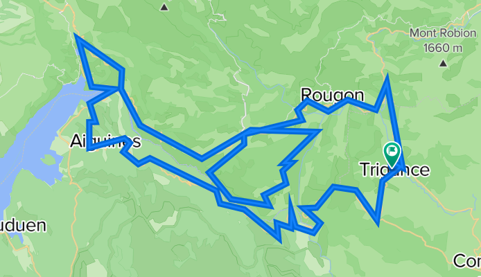
Gorges du Verdon and Route des Crêtes
A cycling route starting in Castellane, Provence-Alpes-Côte d'Azur Region, France.
Overview
About this route
- -:--
- Duration
- 110.9 km
- Distance
- 2,188 m
- Ascent
- 2,188 m
- Descent
- ---
- Avg. speed
- ---
- Max. altitude

Route highlights
Points of interest along the route
Point of interest after 31.2 km
Col de Vaumale - 1201 metres
Point of interest after 34.2 km
Col d'Illoire - ç§è metres
Point of interest after 57 km
Col de l'Olivier 713m
Point of interest after 63.8 km
Col d'Ayen 1032m
Point of interest after 75.4 km
Pas de l'Abauc or Pas de la Bau - 1280 metres
Point of interest after 107 km
Collet d'Ampon 725m
Continue with Bikemap
Use, edit, or download this cycling route
You would like to ride Gorges du Verdon and Route des Crêtes or customize it for your own trip? Here is what you can do with this Bikemap route:
Free features
- Save this route as favorite or in collections
- Copy & plan your own version of this route
- Split it into stages to create a multi-day tour
- Sync your route with Garmin or Wahoo
Premium features
Free trial for 3 days, or one-time payment. More about Bikemap Premium.
- Navigate this route on iOS & Android
- Export a GPX / KML file of this route
- Create your custom printout (try it for free)
- Download this route for offline navigation
Discover more Premium features.
Get Bikemap PremiumFrom our community
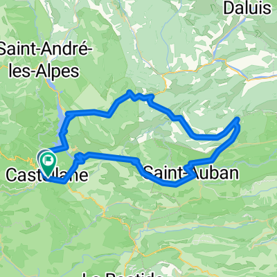
Other popular routes starting in Castellane
 RR Dingo Castel D4 93k
- Distance
- 92.3 km
- Ascent
- 3,352 m
- Descent
- 3,337 m
- Location
- Castellane, Provence-Alpes-Côte d'Azur Region, France
 La Palud-sur-Verdon - Les Salles-sur-Verdon
- Distance
- 19.7 km
- Ascent
- 354 m
- Descent
- 797 m
- Location
- Castellane, Provence-Alpes-Côte d'Azur Region, France
 42 km Le Bourget - Gorges du Verdon
- Distance
- 42.1 km
- Ascent
- 515 m
- Descent
- 512 m
- Location
- Castellane, Provence-Alpes-Côte d'Azur Region, France
 Tour du Verdon
- Distance
- 84.8 km
- Ascent
- 1,726 m
- Descent
- 1,732 m
- Location
- Castellane, Provence-Alpes-Côte d'Azur Region, France
 2016 Ride Day 78 - Castellane to Puget-Théniers
- Distance
- 49.9 km
- Ascent
- 441 m
- Descent
- 749 m
- Location
- Castellane, Provence-Alpes-Côte d'Azur Region, France
 Verdonrunde groß
- Distance
- 100.8 km
- Ascent
- 1,498 m
- Descent
- 1,498 m
- Location
- Castellane, Provence-Alpes-Côte d'Azur Region, France
 Objezd kan.Verdon ze SEVERU_4.den
- Distance
- 41.8 km
- Ascent
- 1,011 m
- Descent
- 1,277 m
- Location
- Castellane, Provence-Alpes-Côte d'Azur Region, France
 RR Dingo Castel D1 81k
- Distance
- 81.7 km
- Ascent
- 2,305 m
- Descent
- 2,299 m
- Location
- Castellane, Provence-Alpes-Côte d'Azur Region, France
Open it in the app