

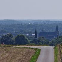
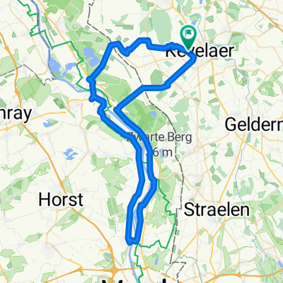
Ausfahrt über Wenn
A cycling route starting in Kevelaer, North Rhine-Westphalia, Germany.
Overview
About this route
Kevelaer to Wemb and passing by Twisteden back to Kevelaer.
- -:--
- Duration
- 20.4 km
- Distance
- 29 m
- Ascent
- 30 m
- Descent
- ---
- Avg. speed
- ---
- Max. altitude
Route quality
Waytypes & surfaces along the route
Waytypes
Track
9.8 km
(48 %)
Quiet road
7.4 km
(36 %)
Surfaces
Paved
17.8 km
(87 %)
Asphalt
11.6 km
(57 %)
Paved (undefined)
6.1 km
(30 %)
Undefined
2.7 km
(13 %)
Continue with Bikemap
Use, edit, or download this cycling route
You would like to ride Ausfahrt über Wenn or customize it for your own trip? Here is what you can do with this Bikemap route:
Free features
- Save this route as favorite or in collections
- Copy & plan your own version of this route
- Sync your route with Garmin or Wahoo
Premium features
Free trial for 3 days, or one-time payment. More about Bikemap Premium.
- Navigate this route on iOS & Android
- Export a GPX / KML file of this route
- Create your custom printout (try it for free)
- Download this route for offline navigation
Discover more Premium features.
Get Bikemap PremiumFrom our community
Other popular routes starting in Kevelaer
 Ausfahrt über Wenn
- Distance
- 20.4 km
- Ascent
- 29 m
- Descent
- 30 m
- Location
- Kevelaer, North Rhine-Westphalia, Germany
 Eifel- Fest
- Distance
- 352.5 km
- Ascent
- 2,096 m
- Descent
- 2,080 m
- Location
- Kevelaer, North Rhine-Westphalia, Germany
 Lüllingen-Gaesdonk-Lüllingen
- Distance
- 49.1 km
- Ascent
- 67 m
- Descent
- 77 m
- Location
- Kevelaer, North Rhine-Westphalia, Germany
 Feriendorf nach Feriendorf 13d
- Distance
- 34.6 km
- Ascent
- 158 m
- Descent
- 202 m
- Location
- Kevelaer, North Rhine-Westphalia, Germany
 über Issum und die Niederlande 🇳🇱
- Distance
- 85.1 km
- Ascent
- 38 m
- Descent
- 36 m
- Location
- Kevelaer, North Rhine-Westphalia, Germany
 Big Challenge 2015 am Niederrhein "Sonsbecker Schweiz bis zu den Römern"
- Distance
- 44.3 km
- Ascent
- 241 m
- Descent
- 239 m
- Location
- Kevelaer, North Rhine-Westphalia, Germany
 An der Maas entlang
- Distance
- 59.7 km
- Ascent
- 61 m
- Descent
- 60 m
- Location
- Kevelaer, North Rhine-Westphalia, Germany
 über die Deiche von Waal und Maas
- Distance
- 201.3 km
- Ascent
- 208 m
- Descent
- 183 m
- Location
- Kevelaer, North Rhine-Westphalia, Germany
Open it in the app