Radtour Feuerwehr 1. Mai 2016
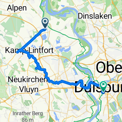
A cycling route starting in Rheinberg, North Rhine-Westphalia, Germany.
Overview
About this route
Von Ossenberg über den Deich bis Orsoy, weiter über Binsheim durch den Baeler-Busch, Richtung Budberg durch Rheinberg zurück nach Ossenberg.
- -:--
- Duration
- 30.1 km
- Distance
- 41 m
- Ascent
- 45 m
- Descent
- ---
- Avg. speed
- ---
- Avg. speed
Route quality
Waytypes & surfaces along the route
Waytypes
Track
9.4 km
(31 %)
Quiet road
7.6 km
(25 %)
Surfaces
Paved
22.2 km
(74 %)
Unpaved
2.3 km
(8 %)
Asphalt
16 km
(53 %)
Paving stones
5.5 km
(18 %)
Continue with Bikemap
Use, edit, or download this cycling route
You would like to ride Radtour Feuerwehr 1. Mai 2016 or customize it for your own trip? Here is what you can do with this Bikemap route:
Free features
- Save this route as favorite or in collections
- Copy & plan your own version of this route
- Sync your route with Garmin or Wahoo
Premium features
Free trial for 3 days, or one-time payment. More about Bikemap Premium.
- Navigate this route on iOS & Android
- Export a GPX / KML file of this route
- Create your custom printout (try it for free)
- Download this route for offline navigation
Discover more Premium features.
Get Bikemap PremiumFrom our community
Other popular routes starting in Rheinberg
- RTF ORSOY 2009 - 111 km Orsoyer Rheinauen
- Distance
- 109.7 km
- Ascent
- 194 m
- Descent
- 192 m
- Location
- Rheinberg, North Rhine-Westphalia, Germany
- Radtour Feuerwehr 1. Mai 2016
- Distance
- 30.1 km
- Ascent
- 41 m
- Descent
- 45 m
- Location
- Rheinberg, North Rhine-Westphalia, Germany
- Immer den Rhein lang
- Distance
- 55.4 km
- Ascent
- 62 m
- Descent
- 63 m
- Location
- Rheinberg, North Rhine-Westphalia, Germany
- Tour 9 - Stadt, Land, Kloster von Rheinberg über Kamp-Lintfort
- Distance
- 54.4 km
- Ascent
- 212 m
- Descent
- 212 m
- Location
- Rheinberg, North Rhine-Westphalia, Germany
- Rhein 2
- Distance
- 28 km
- Ascent
- 41 m
- Descent
- 39 m
- Location
- Rheinberg, North Rhine-Westphalia, Germany
- Schulstraße 4, Rheinberg nach Römerstraße 109, Duisburg
- Distance
- 12.4 km
- Ascent
- 74 m
- Descent
- 113 m
- Location
- Rheinberg, North Rhine-Westphalia, Germany
- Von Kamp-Lintfort bis Duisburg
- Distance
- 31 km
- Ascent
- 58 m
- Descent
- 54 m
- Location
- Rheinberg, North Rhine-Westphalia, Germany
- Rheinberg-Baerl
- Distance
- 29.8 km
- Ascent
- 39 m
- Descent
- 43 m
- Location
- Rheinberg, North Rhine-Westphalia, Germany
Open it in the app