

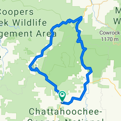
flatland to fish knob
A cycling route starting in Dahlonega, Georgia, United States.
Overview
About this route
- -:--
- Duration
- 22 km
- Distance
- 658 m
- Ascent
- 603 m
- Descent
- ---
- Avg. speed
- ---
- Max. altitude
Route quality
Waytypes & surfaces along the route
Waytypes
Quiet road
9.9 km
(45 %)
Track
9.4 km
(43 %)
Surfaces
Unpaved
18.2 km
(83 %)
Gravel
13.6 km
(62 %)
Unpaved (undefined)
3.3 km
(15 %)
Continue with Bikemap
Use, edit, or download this cycling route
You would like to ride flatland to fish knob or customize it for your own trip? Here is what you can do with this Bikemap route:
Free features
- Save this route as favorite or in collections
- Copy & plan your own version of this route
- Sync your route with Garmin or Wahoo
Premium features
Free trial for 3 days, or one-time payment. More about Bikemap Premium.
- Navigate this route on iOS & Android
- Export a GPX / KML file of this route
- Create your custom printout (try it for free)
- Download this route for offline navigation
Discover more Premium features.
Get Bikemap PremiumFrom our community
Other popular routes starting in Dahlonega
 340 Walmart Way, Dahlonega to 2662 Walnut St, Gainesville
- Distance
- 29.5 km
- Ascent
- 384 m
- Descent
- 443 m
- Location
- Dahlonega, Georgia, United States
 flatland to fish knob
- Distance
- 22 km
- Ascent
- 658 m
- Descent
- 603 m
- Location
- Dahlonega, Georgia, United States
 Small Blood Mtn Ride Wold Pen Gap Rd
- Distance
- 87.8 km
- Ascent
- 1,423 m
- Descent
- 1,353 m
- Location
- Dahlonega, Georgia, United States
 3 Gap counter clockwise
- Distance
- 55.7 km
- Ascent
- 1,033 m
- Descent
- 1,033 m
- Location
- Dahlonega, Georgia, United States
 5–65 Wolf Pen Gap Rd, Suches to 1847–1851 SR-60, Suches
- Distance
- 9.2 km
- Ascent
- 171 m
- Descent
- 173 m
- Location
- Dahlonega, Georgia, United States
 Fool's Gold 50 2013 Race Course
- Distance
- 81.8 km
- Ascent
- 1,292 m
- Descent
- 1,291 m
- Location
- Dahlonega, Georgia, United States
 Elijay GA 2 Day Route
- Distance
- 99.9 km
- Ascent
- 1,459 m
- Descent
- 1,457 m
- Location
- Dahlonega, Georgia, United States
 1852 SR-60, Suches to US-19 N, Dahlonega
- Distance
- 11.8 km
- Ascent
- 161 m
- Descent
- 426 m
- Location
- Dahlonega, Georgia, United States
Open it in the app