

Laredo – Castro Urdiales
A cycling route starting in Laredo, Cantabria, Spain.
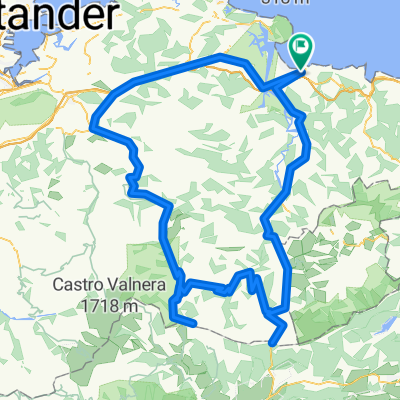
Overview
About this route
Cumbres:
LOS TORNOS (Km. 48)Altitude: 741 mLength: 16,1 km
Elevation gain: 659 m
% average: 4,1%
ASÓN (Km. 73)
Altitude: 696 m Length: 8 km Elevation gain: 479 m
% average: 6,2%
CAMPOLAYAL (Km. 128)
Altitude: 436 m Length: 8,2 km Elevation gain: 386 m
% average: 4,7%
HOYOMENOR (Km. 140)
Altitude: 362 m
Length: 7,1 km
Elevation gain: 332 m
% average: 4,74%
LA GRANJA (km. 156,5)
Altitude: 392 m Length: 5 km Elevation gain: 337 m
% average: 6,9%
- -:--
- Duration
- 165.9 km
- Distance
- 4,680 m
- Ascent
- 4,530 m
- Descent
- ---
- Avg. speed
- 739 m
- Max. altitude
Route quality
Waytypes & surfaces along the route
Waytypes
Road
54.8 km
(33 %)
Cycleway
26.5 km
(16 %)
Surfaces
Paved
51.4 km
(31 %)
Unpaved
1.7 km
(1 %)
Asphalt
51.4 km
(31 %)
Unpaved (undefined)
1.7 km
(1 %)
Undefined
112.8 km
(68 %)
Continue with Bikemap
Use, edit, or download this cycling route
You would like to ride Laredo – Castro Urdiales or customize it for your own trip? Here is what you can do with this Bikemap route:
Free features
- Save this route as favorite or in collections
- Copy & plan your own version of this route
- Split it into stages to create a multi-day tour
- Sync your route with Garmin or Wahoo
Premium features
Free trial for 3 days, or one-time payment. More about Bikemap Premium.
- Navigate this route on iOS & Android
- Export a GPX / KML file of this route
- Create your custom printout (try it for free)
- Download this route for offline navigation
Discover more Premium features.
Get Bikemap PremiumFrom our community
Other popular routes starting in Laredo
 Cantabria01
- Distance
- 120.2 km
- Ascent
- 1,752 m
- Descent
- 1,582 m
- Location
- Laredo, Cantabria, Spain
 Laredo-Lunada-La Sía-Laredo
- Distance
- 136.2 km
- Ascent
- 1,809 m
- Descent
- 1,812 m
- Location
- Laredo, Cantabria, Spain
 Lunada_ElCaracol_LaBraguia_EstacasDeTrueba_LosMachucos
- Distance
- 221.2 km
- Ascent
- 3,818 m
- Descent
- 3,818 m
- Location
- Laredo, Cantabria, Spain
 Ruta del ASON
- Distance
- 165.2 km
- Ascent
- 2,632 m
- Descent
- 2,632 m
- Location
- Laredo, Cantabria, Spain
 17. Etappe Laredo - Comillas ca. 109km 04.07.
- Distance
- 110.3 km
- Ascent
- 533 m
- Descent
- 561 m
- Location
- Laredo, Cantabria, Spain
 Laredo -Estacion de Esqui Lunada
- Distance
- 204.7 km
- Ascent
- 4,853 m
- Descent
- 3,579 m
- Location
- Laredo, Cantabria, Spain
 Laredo-Arredondo-Alisas-Lunada
- Distance
- 94.4 km
- Ascent
- 0 m
- Descent
- 0 m
- Location
- Laredo, Cantabria, Spain
 Alisas_LaSia_LosTornos
- Distance
- 153.8 km
- Ascent
- 2,447 m
- Descent
- 2,446 m
- Location
- Laredo, Cantabria, Spain
Open it in the app