

Engers-Andernach
A cycling route starting in Kaltenengers, Rhineland-Palatinate, Germany.
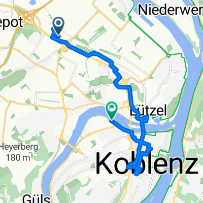
Overview
About this route
- -:--
- Duration
- 14.4 km
- Distance
- 28 m
- Ascent
- 34 m
- Descent
- ---
- Avg. speed
- ---
- Max. altitude

Route highlights
Points of interest along the route
Point of interest after 2.6 km
Rheinbrücke Engers-Urmitz
Continue with Bikemap
Use, edit, or download this cycling route
You would like to ride Engers-Andernach or customize it for your own trip? Here is what you can do with this Bikemap route:
Free features
- Save this route as favorite or in collections
- Copy & plan your own version of this route
- Sync your route with Garmin or Wahoo
Premium features
Free trial for 3 days, or one-time payment. More about Bikemap Premium.
- Navigate this route on iOS & Android
- Export a GPX / KML file of this route
- Create your custom printout (try it for free)
- Download this route for offline navigation
Discover more Premium features.
Get Bikemap PremiumFrom our community
Other popular routes starting in Kaltenengers
 Rundtour Engers Nauort
- Distance
- 25.7 km
- Ascent
- 425 m
- Descent
- 422 m
- Location
- Kaltenengers, Rhineland-Palatinate, Germany
 0006e Dernbach_Bonefeld_Oberbieber
- Distance
- 48.3 km
- Ascent
- 881 m
- Descent
- 882 m
- Location
- Kaltenengers, Rhineland-Palatinate, Germany
 Testroute nach Bingen
- Distance
- 75.2 km
- Ascent
- 290 m
- Descent
- 280 m
- Location
- Kaltenengers, Rhineland-Palatinate, Germany
 Maifeldtour
- Distance
- 56.7 km
- Ascent
- 525 m
- Descent
- 528 m
- Location
- Kaltenengers, Rhineland-Palatinate, Germany
 Engers-Andernach
- Distance
- 14.4 km
- Ascent
- 30 m
- Descent
- 36 m
- Location
- Kaltenengers, Rhineland-Palatinate, Germany
 11,5km_0h50_Hornbach-Steinert-Dück-StdBib-Contel_via Lützel
- Distance
- 11.3 km
- Ascent
- 42 m
- Descent
- 49 m
- Location
- Kaltenengers, Rhineland-Palatinate, Germany
 Engers Laacher See und zurück
- Distance
- 65.2 km
- Ascent
- 372 m
- Descent
- 372 m
- Location
- Kaltenengers, Rhineland-Palatinate, Germany
 Test Engers Andernach
- Distance
- 14.5 km
- Ascent
- 35 m
- Descent
- 40 m
- Location
- Kaltenengers, Rhineland-Palatinate, Germany
Open it in the app