Haidenaab Radweg - Variante nach Vilseck
A cycling route starting in Vilseck, Bavaria, Germany.
Overview
About this route
Haidenaab Radweg - Variante nach Vilseck
Von Bayreuth nach Weidenberg folgt der Weg weitgehend autofrei dem landschaftlich reizvollen Tal der Steinach. Anschließend wird zwischen Weidenberg und Seybothenreuth mit dem höchsten Punkt dieser Route (540 m üNN) auch die europäische Hauptwasserscheide überschritten. Kirchenlaibach wird am Ende der Fahrt durch ein ruhiges Tal erreicht. Von Speichersdorf bis nach Wirbenz steigt der Weg nochmals über einen Höhenrücken, um schließlich im Tal der Haidenaab flach (470-400 m üNN) über Kastl, Pressath. In Hütten Abzweig nach Vilseck (bzw. Freihung) im VGN Verbundbegbiet.
- -:--
- Duration
- 88.3 km
- Distance
- 337 m
- Ascent
- 403 m
- Descent
- ---
- Avg. speed
- ---
- Avg. speed
Route highlights
Points of interest along the route
Point of interest after 10.3 km
Abzweigemöglichkeit nach Freihung (Bahnhof innerhalb des VGN Verbundgebietes)
Point of interest after 17.9 km
Abzweig vom Haidenaabradweg - ab hier Richtung Freihung bzw. Vilseck
Continue with Bikemap
Use, edit, or download this cycling route
You would like to ride Haidenaab Radweg - Variante nach Vilseck or customize it for your own trip? Here is what you can do with this Bikemap route:
Free features
- Save this route as favorite or in collections
- Copy & plan your own version of this route
- Sync your route with Garmin or Wahoo
Premium features
Free trial for 3 days, or one-time payment. More about Bikemap Premium.
- Navigate this route on iOS & Android
- Export a GPX / KML file of this route
- Create your custom printout (try it for free)
- Download this route for offline navigation
Discover more Premium features.
Get Bikemap PremiumFrom our community
Other popular routes starting in Vilseck
- Leonhardstraße 30, Vilseck nach Leonhardstraße 30, Vilseck
- Distance
- 42.1 km
- Ascent
- 509 m
- Descent
- 519 m
- Location
- Vilseck, Bavaria, Germany
- Route nach Leonhardstraße 30, Vilseck
- Distance
- 10 km
- Ascent
- 113 m
- Descent
- 132 m
- Location
- Vilseck, Bavaria, Germany
- 2.Etappe Dresden
- Distance
- 126 km
- Ascent
- 718 m
- Descent
- 747 m
- Location
- Vilseck, Bavaria, Germany
- Leonhardstraße 30, Vilseck nach Leonhardstraße 30, Vilseck
- Distance
- 27.6 km
- Ascent
- 294 m
- Descent
- 305 m
- Location
- Vilseck, Bavaria, Germany
- Leonhardstraße 30, Vilseck nach Kolpingstraße 14, Vilseck
- Distance
- 21.4 km
- Ascent
- 233 m
- Descent
- 233 m
- Location
- Vilseck, Bavaria, Germany
- Freihunger Straße, Vilseck nach Freihunger Straße, Vilseck
- Distance
- 40 km
- Ascent
- 571 m
- Descent
- 569 m
- Location
- Vilseck, Bavaria, Germany
- Vilseck_Kurmreuth_loops
- Distance
- 50.3 km
- Ascent
- 225 m
- Descent
- 230 m
- Location
- Vilseck, Bavaria, Germany
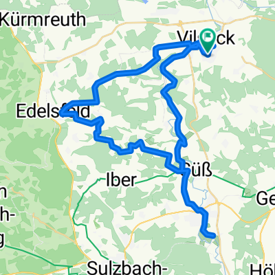
- Amberger Straße 1, Vilseck nach Leonhardstraße 30, Vilseck
- Distance
- 22.8 km
- Ascent
- 198 m
- Descent
- 179 m
- Location
- Vilseck, Bavaria, Germany
Open it in the app