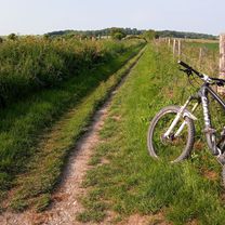
New training May/June
A cycling route starting in Hove, England, United Kingdom.
Overview
About this route
Includes climb Olive Road & Victoria Road, Trafalgar Road and Gardiner Road 'dips'
- -:--
- Duration
- 14.7 km
- Distance
- 37 m
- Ascent
- 37 m
- Descent
- ---
- Avg. speed
- ---
- Avg. speed
Route quality
Waytypes & surfaces along the route
Waytypes
Quiet road
8.4 km
(57 %)
Busy road
2.4 km
(16 %)
Surfaces
Paved
12.1 km
(82 %)
Asphalt
12 km
(82 %)
Paved (undefined)
0 km
(<1 %)
Undefined
2.7 km
(18 %)
Continue with Bikemap
Use, edit, or download this cycling route
You would like to ride New training May/June or customize it for your own trip? Here is what you can do with this Bikemap route:
Free features
- Save this route as favorite or in collections
- Copy & plan your own version of this route
- Sync your route with Garmin or Wahoo
Premium features
Free trial for 3 days, or one-time payment. More about Bikemap Premium.
- Navigate this route on iOS & Android
- Export a GPX / KML file of this route
- Create your custom printout (try it for free)
- Download this route for offline navigation
Discover more Premium features.
Get Bikemap PremiumFrom our community
Other popular routes starting in Hove
- 25m loop via Devils Dyke & Coombes
- Distance
- 40.8 km
- Ascent
- 272 m
- Descent
- 271 m
- Location
- Hove, England, United Kingdom
- Quick Pre Work Marina Ride
- Distance
- 11.8 km
- Ascent
- 57 m
- Descent
- 38 m
- Location
- Hove, England, United Kingdom
- Hove Park to the South Downs
- Distance
- 49.7 km
- Ascent
- 592 m
- Descent
- 559 m
- Location
- Hove, England, United Kingdom
- Hove, Newhaven, Lewes, Hurstpierpoint, Henfield, Shoreham loop
- Distance
- 77.8 km
- Ascent
- 527 m
- Descent
- 554 m
- Location
- Hove, England, United Kingdom
- Weekday Shoreham loop (22m)
- Distance
- 33.9 km
- Ascent
- 250 m
- Descent
- 283 m
- Location
- Hove, England, United Kingdom
- Devil's Dyke Medium Loop
- Distance
- 16.7 km
- Ascent
- 214 m
- Descent
- 217 m
- Location
- Hove, England, United Kingdom
- Eastward loop
- Distance
- 83.2 km
- Ascent
- 450 m
- Descent
- 450 m
- Location
- Hove, England, United Kingdom
- lumpy loop
- Distance
- 41.3 km
- Ascent
- 314 m
- Descent
- 256 m
- Location
- Hove, England, United Kingdom