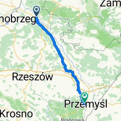
104 (28/16) Stalowa Wola-Bojanów-Brzóza Król.-Żołynia-Mikulice-Kańczuga
A cycling route starting in Stalowa Wola, Subcarpathian Voivodeship, Poland.
Overview
About this route
In Przyszów, a bridge is under renovation, the crossing over the old meander of the Łęg is being done via a concrete footbridge.
- -:--
- Duration
- 103.7 km
- Distance
- 255 m
- Ascent
- 218 m
- Descent
- ---
- Avg. speed
- ---
- Max. altitude
Route quality
Waytypes & surfaces along the route
Waytypes
Road
52.9 km
(51 %)
Quiet road
12.4 km
(12 %)
Surfaces
Paved
88.1 km
(85 %)
Asphalt
88.1 km
(85 %)
Undefined
15.6 km
(15 %)
Continue with Bikemap
Use, edit, or download this cycling route
You would like to ride 104 (28/16) Stalowa Wola-Bojanów-Brzóza Król.-Żołynia-Mikulice-Kańczuga or customize it for your own trip? Here is what you can do with this Bikemap route:
Free features
- Save this route as favorite or in collections
- Copy & plan your own version of this route
- Split it into stages to create a multi-day tour
- Sync your route with Garmin or Wahoo
Premium features
Free trial for 3 days, or one-time payment. More about Bikemap Premium.
- Navigate this route on iOS & Android
- Export a GPX / KML file of this route
- Create your custom printout (try it for free)
- Download this route for offline navigation
Discover more Premium features.
Get Bikemap PremiumFrom our community
Other popular routes starting in Stalowa Wola
- 104 (28/16) Stalowa Wola-Bojanów-Brzóza Król.-Żołynia-Mikulice-Kańczuga
- Distance
- 103.7 km
- Ascent
- 255 m
- Descent
- 218 m
- Location
- Stalowa Wola, Subcarpathian Voivodeship, Poland
- Wyśmienita i wszechstronna trasa na wierczorne: bieganie/jazdę na rolkach/jazdę na rowerze.
- Distance
- 6.4 km
- Ascent
- 24 m
- Descent
- 26 m
- Location
- Stalowa Wola, Subcarpathian Voivodeship, Poland
- Krótki trip po lesie
- Distance
- 55.3 km
- Ascent
- 177 m
- Descent
- 177 m
- Location
- Stalowa Wola, Subcarpathian Voivodeship, Poland
- Stalowa Wola Rozwadów - Huta Szklana
- Distance
- 123.9 km
- Ascent
- 810 m
- Descent
- 537 m
- Location
- Stalowa Wola, Subcarpathian Voivodeship, Poland
- Chwilowo nie pada więc jadę na grzyby
- Distance
- 19.9 km
- Ascent
- 67 m
- Descent
- 67 m
- Location
- Stalowa Wola, Subcarpathian Voivodeship, Poland
- Łącznik Greenvelo przez Lasy Państwowe
- Distance
- 12.7 km
- Ascent
- 33 m
- Descent
- 30 m
- Location
- Stalowa Wola, Subcarpathian Voivodeship, Poland
- Lasem Lipskim na jeżyny
- Distance
- 50.8 km
- Ascent
- 215 m
- Descent
- 217 m
- Location
- Stalowa Wola, Subcarpathian Voivodeship, Poland
- Rowerowa trasa do PxM 2011/2012
- Distance
- 44.8 km
- Ascent
- 57 m
- Descent
- 57 m
- Location
- Stalowa Wola, Subcarpathian Voivodeship, Poland
Open it in the app