

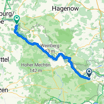
BR 2016 Gartow
A cycling route starting in Gartow, Lower Saxony, Germany.
Overview
About this route
- -:--
- Duration
- 25.5 km
- Distance
- 108 m
- Ascent
- 110 m
- Descent
- ---
- Avg. speed
- ---
- Max. altitude
Route quality
Waytypes & surfaces along the route
Waytypes
Track
12.7 km
(50 %)
Quiet road
4.8 km
(19 %)
Surfaces
Paved
7.1 km
(28 %)
Unpaved
9.4 km
(37 %)
Gravel
5.9 km
(23 %)
Concrete
4.3 km
(17 %)
Route highlights
Points of interest along the route
Point of interest after 1.8 km
Beobachtungsstand Meisen, Nachtigallen, übrige Kleinvögel
Point of interest after 3.4 km
Elbe
Point of interest after 4.7 km
Beobachtungsstand Limikolen, Wassergeflügel und Schilfbewohner
Point of interest after 12.3 km
Bodenentnahmestelle Vietze Grauammer...
Point of interest after 14.1 km
Beobachtungsstand am Laascher See Enten, Gänse, Seeadler, Fischadler...
Point of interest after 16 km
Brünkendorfer Teiche - NABU Schutzgebiet mit Beobachtungsstand. Gänse und Enten, Eisvogel
Point of interest after 25.4 km
Startpunkt Parkplatz Quarnstedt
Continue with Bikemap
Use, edit, or download this cycling route
You would like to ride BR 2016 Gartow or customize it for your own trip? Here is what you can do with this Bikemap route:
Free features
- Save this route as favorite or in collections
- Copy & plan your own version of this route
- Sync your route with Garmin or Wahoo
Premium features
Free trial for 3 days, or one-time payment. More about Bikemap Premium.
- Navigate this route on iOS & Android
- Export a GPX / KML file of this route
- Create your custom printout (try it for free)
- Download this route for offline navigation
Discover more Premium features.
Get Bikemap PremiumFrom our community
Other popular routes starting in Gartow
 solo_2024_22_Elbe-2_Gartow -
- Distance
- 133.2 km
- Ascent
- 280 m
- Descent
- 252 m
- Location
- Gartow, Lower Saxony, Germany
 Laschersee
- Distance
- 18.9 km
- Ascent
- 95 m
- Descent
- 96 m
- Location
- Gartow, Lower Saxony, Germany
 Di_Etappe-4 Von Gartow bis Hitzacker (Elbe)
- Distance
- 77 km
- Ascent
- 245 m
- Descent
- 255 m
- Location
- Gartow, Lower Saxony, Germany
 Gartow - Neuenkirchen
- Distance
- 158.4 km
- Ascent
- 299 m
- Descent
- 250 m
- Location
- Gartow, Lower Saxony, Germany
 3. Etap. Elberadweg, Gartow - Havelberg
- Distance
- 67.3 km
- Ascent
- 59 m
- Descent
- 51 m
- Location
- Gartow, Lower Saxony, Germany
 D 050-3: Gartow - Waren/Müritz
- Distance
- 141.3 km
- Ascent
- 260 m
- Descent
- 208 m
- Location
- Gartow, Lower Saxony, Germany
 Elbe-Heide-Tour
- Distance
- 51.2 km
- Ascent
- 123 m
- Descent
- 123 m
- Location
- Gartow, Lower Saxony, Germany
 D 50-3: Gartow (Elbe) - Waren (Müritz)
- Distance
- 144.8 km
- Ascent
- 246 m
- Descent
- 191 m
- Location
- Gartow, Lower Saxony, Germany
Open it in the app