

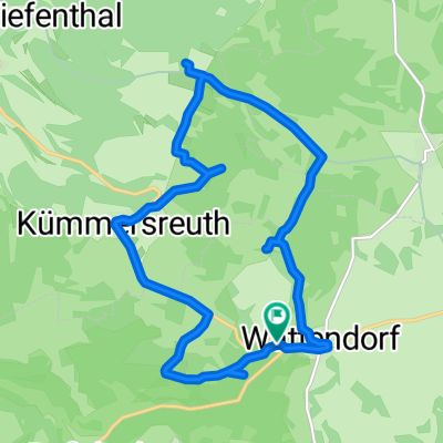
Oberküps-Ebensfeld-Reundorf-Oberküps
A cycling route starting in Wattendorf, Bavaria, Germany.
Overview
About this route
Beautiful tour on the Obermain
- -:--
- Duration
- 38.9 km
- Distance
- 168 m
- Ascent
- 173 m
- Descent
- ---
- Avg. speed
- ---
- Max. altitude

Route quality
Waytypes & surfaces along the route
Waytypes
Quiet road
13.6 km
(35 %)
Track
12.4 km
(32 %)
Surfaces
Paved
24.5 km
(63 %)
Unpaved
8.9 km
(23 %)
Asphalt
23.7 km
(61 %)
Gravel
5.1 km
(13 %)
Continue with Bikemap
Use, edit, or download this cycling route
You would like to ride Oberküps-Ebensfeld-Reundorf-Oberküps or customize it for your own trip? Here is what you can do with this Bikemap route:
Free features
- Save this route as favorite or in collections
- Copy & plan your own version of this route
- Sync your route with Garmin or Wahoo
Premium features
Free trial for 3 days, or one-time payment. More about Bikemap Premium.
- Navigate this route on iOS & Android
- Export a GPX / KML file of this route
- Create your custom printout (try it for free)
- Download this route for offline navigation
Discover more Premium features.
Get Bikemap PremiumFrom our community
Other popular routes starting in Wattendorf
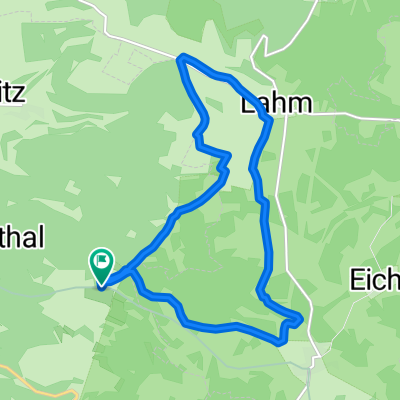
 Unterzettlitz-staffelberg-lahm-unterzettlitz
- Distance
- 1.8 km
- Ascent
- 100 m
- Descent
- 356 m
- Location
- Wattendorf, Bavaria, Germany
 Rundwanderung Roßdach-Kemitzenstein-Wattendorf
- Distance
- 15.4 km
- Ascent
- 285 m
- Descent
- 291 m
- Location
- Wattendorf, Bavaria, Germany
 HT 2017-2 Rund um Bamberg
- Distance
- 66.2 km
- Ascent
- 296 m
- Descent
- 345 m
- Location
- Wattendorf, Bavaria, Germany
 Lahme(r) Runde bei Wattendorf Rothmannsthal
- Distance
- 11.6 km
- Ascent
- 209 m
- Descent
- 208 m
- Location
- Wattendorf, Bavaria, Germany
 test
test- Distance
- 202.8 km
- Ascent
- 1,206 m
- Descent
- 1,264 m
- Location
- Wattendorf, Bavaria, Germany
 Kur FRM Kur
- Distance
- 103.7 km
- Ascent
- 802 m
- Descent
- 701 m
- Location
- Wattendorf, Bavaria, Germany
 Brotzeit machen in Schederndorf
- Distance
- 17.8 km
- Ascent
- 202 m
- Descent
- 196 m
- Location
- Wattendorf, Bavaria, Germany
 Wattendorf
- Distance
- 13 km
- Ascent
- 211 m
- Descent
- 214 m
- Location
- Wattendorf, Bavaria, Germany
Open it in the app