

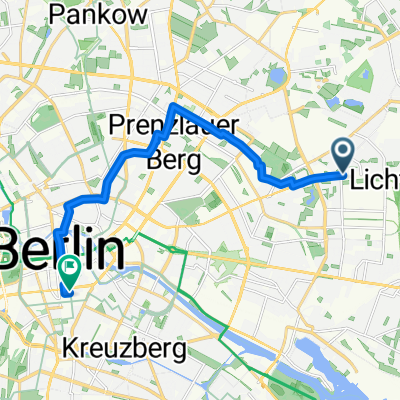
091108 CX Wuhlewanderweg
A cycling route starting in Fennpfuhl, State of Berlin, Germany.
Overview
About this route
- -:--
- Duration
- 44.4 km
- Distance
- 71 m
- Ascent
- 73 m
- Descent
- ---
- Avg. speed
- ---
- Max. altitude

Continue with Bikemap
Use, edit, or download this cycling route
You would like to ride 091108 CX Wuhlewanderweg or customize it for your own trip? Here is what you can do with this Bikemap route:
Free features
- Save this route as favorite or in collections
- Copy & plan your own version of this route
- Sync your route with Garmin or Wahoo
Premium features
Free trial for 3 days, or one-time payment. More about Bikemap Premium.
- Navigate this route on iOS & Android
- Export a GPX / KML file of this route
- Create your custom printout (try it for free)
- Download this route for offline navigation
Discover more Premium features.
Get Bikemap PremiumFrom our community
Other popular routes starting in Fennpfuhl
 Route in Berlin
- Distance
- 11.8 km
- Ascent
- 53 m
- Descent
- 66 m
- Location
- Fennpfuhl, State of Berlin, Germany
 Lanke Runde
- Distance
- 88.8 km
- Ascent
- 175 m
- Descent
- 159 m
- Location
- Fennpfuhl, State of Berlin, Germany
 Rund um den Müggelsee
- Distance
- 57.4 km
- Ascent
- 88 m
- Descent
- 106 m
- Location
- Fennpfuhl, State of Berlin, Germany
 Nördliche Schleife
- Distance
- 96.3 km
- Ascent
- 138 m
- Descent
- 138 m
- Location
- Fennpfuhl, State of Berlin, Germany
 Mittwochsrunde
- Distance
- 85.8 km
- Ascent
- 121 m
- Descent
- 122 m
- Location
- Fennpfuhl, State of Berlin, Germany
 Frühaufsteher über Hönow
- Distance
- 34.4 km
- Ascent
- 83 m
- Descent
- 85 m
- Location
- Fennpfuhl, State of Berlin, Germany
 Verborgenes Berlin 2
- Distance
- 51.9 km
- Ascent
- 214 m
- Descent
- 211 m
- Location
- Fennpfuhl, State of Berlin, Germany
 Anfahrt zum Start Winterrunde
- Distance
- 13.9 km
- Ascent
- 45 m
- Descent
- 52 m
- Location
- Fennpfuhl, State of Berlin, Germany
Open it in the app