Confolens to Augignac
A cycling route starting in Confolens, Nouvelle-Aquitaine, France.
Overview
About this route
- -:--
- Duration
- 65.7 km
- Distance
- 514 m
- Ascent
- 369 m
- Descent
- ---
- Avg. speed
- ---
- Max. altitude
Route quality
Waytypes & surfaces along the route
Waytypes
Road
18.4 km
(28 %)
Quiet road
13.8 km
(21 %)
Surfaces
Paved
25 km
(38 %)
Unpaved
3.9 km
(6 %)
Asphalt
25 km
(38 %)
Ground
3.9 km
(6 %)
Undefined
36.8 km
(56 %)
Route highlights
Points of interest along the route
Accommodation after 29.7 km
La Campagnard, 3 rue Grand'Rue de Babaudus, Rochechouart,
Accommodation after 48.7 km
Le Jardin des Oiseaux, Lartimache, La Chapelle-Montbrandeix
Accommodation after 50.1 km
Sanouva, 10 Rue d' Angouleme, Saint-Mathieu
Continue with Bikemap
Use, edit, or download this cycling route
You would like to ride Confolens to Augignac or customize it for your own trip? Here is what you can do with this Bikemap route:
Free features
- Save this route as favorite or in collections
- Copy & plan your own version of this route
- Sync your route with Garmin or Wahoo
Premium features
Free trial for 3 days, or one-time payment. More about Bikemap Premium.
- Navigate this route on iOS & Android
- Export a GPX / KML file of this route
- Create your custom printout (try it for free)
- Download this route for offline navigation
Discover more Premium features.
Get Bikemap PremiumFrom our community
Other popular routes starting in Confolens
Schweiz - Atlantik; 10. Etappe Confolens (Camping Municipal) - Bourg Charante (Camping)- Distance
- 108.7 km
- Ascent
- 734 m
- Descent
- 828 m
- Location
- Confolens, Nouvelle-Aquitaine, France
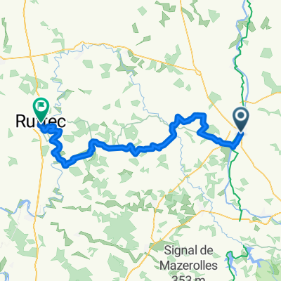
9 bis Rue Fontaine de Guimard, Confolens to 11 Rue Fontaine de Guimard, Confolens- Distance
- 61 km
- Ascent
- 1,018 m
- Descent
- 1,017 m
- Location
- Confolens, Nouvelle-Aquitaine, France
Confolence to Civray- Distance
- 88.5 km
- Ascent
- 837 m
- Descent
- 841 m
- Location
- Confolens, Nouvelle-Aquitaine, France
Confolens to Rochechouart- Distance
- 32.9 km
- Ascent
- 320 m
- Descent
- 221 m
- Location
- Confolens, Nouvelle-Aquitaine, France
Confolens to Etagnac longer- Distance
- 76.8 km
- Ascent
- 991 m
- Descent
- 986 m
- Location
- Confolens, Nouvelle-Aquitaine, France
Confolens to La Chabroulie, near Saint-Mathieu- Distance
- 55.2 km
- Ascent
- 519 m
- Descent
- 389 m
- Location
- Confolens, Nouvelle-Aquitaine, France
To Allue and beyond- Distance
- 55.5 km
- Ascent
- 640 m
- Descent
- 640 m
- Location
- Confolens, Nouvelle-Aquitaine, France
Confolens to La Chapelle-Montbrandeix- Distance
- 55.5 km
- Ascent
- 584 m
- Descent
- 329 m
- Location
- Confolens, Nouvelle-Aquitaine, France
Open it in the app


