

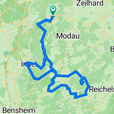
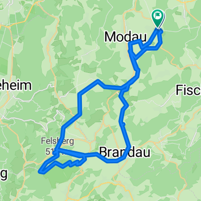
Ober Ramstadt -Lago di Garda (Malcesine) 1. Tag
A cycling route starting in Ober-Ramstadt, Hesse, Germany.
Overview
About this route
Day 1 of a stage ride from the Rhine-Main area to Lake Garda.
For road bike.
7 riding days
- -:--
- Duration
- 127.6 km
- Distance
- 1,383 m
- Ascent
- 1,311 m
- Descent
- ---
- Avg. speed
- 460 m
- Max. altitude
Route quality
Waytypes & surfaces along the route
Waytypes
Road
33.2 km
(26 %)
Track
17.9 km
(14 %)
Surfaces
Paved
94.5 km
(74 %)
Unpaved
6.4 km
(5 %)
Asphalt
86.8 km
(68 %)
Paved (undefined)
7.7 km
(6 %)
Continue with Bikemap
Use, edit, or download this cycling route
You would like to ride Ober Ramstadt -Lago di Garda (Malcesine) 1. Tag or customize it for your own trip? Here is what you can do with this Bikemap route:
Free features
- Save this route as favorite or in collections
- Copy & plan your own version of this route
- Split it into stages to create a multi-day tour
- Sync your route with Garmin or Wahoo
Premium features
Free trial for 3 days, or one-time payment. More about Bikemap Premium.
- Navigate this route on iOS & Android
- Export a GPX / KML file of this route
- Create your custom printout (try it for free)
- Download this route for offline navigation
Discover more Premium features.
Get Bikemap PremiumFrom our community
Other popular routes starting in Ober-Ramstadt
 Burg Frankenstein
- Distance
- 39.8 km
- Ascent
- 531 m
- Descent
- 531 m
- Location
- Ober-Ramstadt, Hesse, Germany
 Gimme Five!
- Distance
- 65.2 km
- Ascent
- 1,059 m
- Descent
- 1,059 m
- Location
- Ober-Ramstadt, Hesse, Germany
 Rundkurs Modau - Groß-Bieberau - Reinheim
- Distance
- 22.6 km
- Ascent
- 243 m
- Descent
- 243 m
- Location
- Ober-Ramstadt, Hesse, Germany
 BT Burgruine Rodenstein
- Distance
- 37 km
- Ascent
- 482 m
- Descent
- 482 m
- Location
- Ober-Ramstadt, Hesse, Germany
 Felsenmeer
- Distance
- 38.1 km
- Ascent
- 524 m
- Descent
- 524 m
- Location
- Ober-Ramstadt, Hesse, Germany
 Lichtenberger Schloss
- Distance
- 29.5 km
- Ascent
- 301 m
- Descent
- 289 m
- Location
- Ober-Ramstadt, Hesse, Germany
 Gemütliche Route in Ober-Ramstadt/Roßdorf/Fischerhütte
- Distance
- 22.1 km
- Ascent
- 505 m
- Descent
- 505 m
- Location
- Ober-Ramstadt, Hesse, Germany
 Frühsport Runde Trautheimer Forst
- Distance
- 6.1 km
- Ascent
- 151 m
- Descent
- 198 m
- Location
- Ober-Ramstadt, Hesse, Germany
Open it in the app