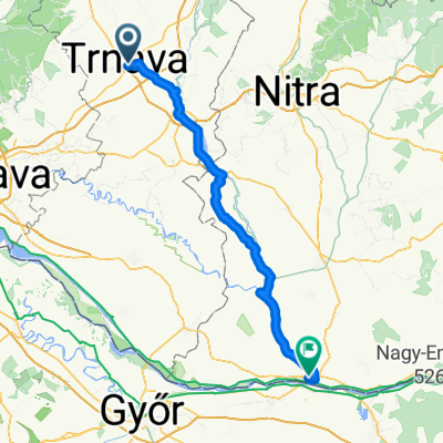
TT-50
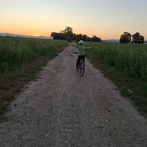
A cycling route starting in Trnava, Trnava Region, Slovakia.
Overview
About this route
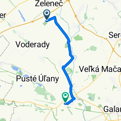
Trnava-Mihalinova-Katarinka-Katlovce-
Malzenice-Trnava
- -:--
- Duration
- 56.5 km
- Distance
- 419 m
- Ascent
- 416 m
- Descent
- ---
- Avg. speed
- 455 m
- Max. altitude
Route quality
Waytypes & surfaces along the route
Waytypes
Road
28.8 km
(51 %)
Track
13.6 km
(24 %)
Surfaces
Paved
29.4 km
(52 %)
Unpaved
11.9 km
(21 %)
Asphalt
29.4 km
(52 %)
Unpaved (undefined)
5.1 km
(9 %)
Continue with Bikemap
Use, edit, or download this cycling route
You would like to ride TT-50 or customize it for your own trip? Here is what you can do with this Bikemap route:
Free features
- Save this route as favorite or in collections
- Copy & plan your own version of this route
- Sync your route with Garmin or Wahoo
Premium features
Free trial for 3 days, or one-time payment. More about Bikemap Premium.
- Navigate this route on iOS & Android
- Export a GPX / KML file of this route
- Create your custom printout (try it for free)
- Download this route for offline navigation
Discover more Premium features.
Get Bikemap PremiumFrom our community
Other popular routes starting in Trnava
- Trnava - Zavar - Šúrovce - Siladice
- Distance
- 37.6 km
- Ascent
- 61 m
- Descent
- 60 m
- Location
- Trnava, Trnava Region, Slovakia
- Trnava - Lošonec - Plavecký Mikuláš
- Distance
- 33.8 km
- Ascent
- 440 m
- Descent
- 339 m
- Location
- Trnava, Trnava Region, Slovakia
- BK - Zoška - Červený kameň - BK
- Distance
- 47.5 km
- Ascent
- 475 m
- Descent
- 472 m
- Location
- Trnava, Trnava Region, Slovakia
- Recording from 30. júla 3:40
- Distance
- 300.7 km
- Ascent
- 2,088 m
- Descent
- 1,461 m
- Location
- Trnava, Trnava Region, Slovakia
- Biely Kostal
- Distance
- 11.3 km
- Ascent
- 20 m
- Descent
- 17 m
- Location
- Trnava, Trnava Region, Slovakia
- Farská púť 2018
- Distance
- 247.1 km
- Ascent
- 549 m
- Descent
- 540 m
- Location
- Trnava, Trnava Region, Slovakia
- Stredná trasa Častá
- Distance
- 25.5 km
- Ascent
- 263 m
- Descent
- 144 m
- Location
- Trnava, Trnava Region, Slovakia
- Opojský malý okruh
- Distance
- 19.3 km
- Ascent
- 41 m
- Descent
- 40 m
- Location
- Trnava, Trnava Region, Slovakia
Open it in the app