

Tour de France 2016 dzień 9
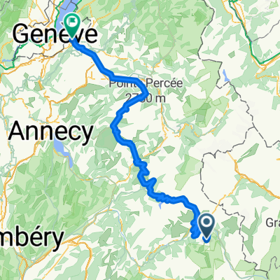
A cycling route starting in Séez, Auvergne-Rhône-Alpes, France.
Overview
About this route
Le Villard – La Thuile – Le Villaret – Le Chevril – Le Villaret du Nial – La Reculaz – La Daille – Le Cret – VAL D’ISERE – Le Fornet – (Col de I’Iseran 2770 m) – Bonneval-sur-Arc – Bessans (902A-902) – L’Adroit – Les Champs – Lanslebourg-Mont-Cenis (D1006) – Termignon – Sollieres – Le Verney – Les Glieres – Villarodin - MODANE – MODANE (¿??)
- -:--
- Duration
- 92.4 km
- Distance
- 1,743 m
- Ascent
- 1,841 m
- Descent
- ---
- Avg. speed
- ---
- Max. altitude

Continue with Bikemap
Use, edit, or download this cycling route
You would like to ride Tour de France 2016 dzień 9 or customize it for your own trip? Here is what you can do with this Bikemap route:
Free features
- Save this route as favorite or in collections
- Copy & plan your own version of this route
- Split it into stages to create a multi-day tour
- Sync your route with Garmin or Wahoo
Premium features
Free trial for 3 days, or one-time payment. More about Bikemap Premium.
- Navigate this route on iOS & Android
- Export a GPX / KML file of this route
- Create your custom printout (try it for free)
- Download this route for offline navigation
Discover more Premium features.
Get Bikemap PremiumFrom our community
Other popular routes starting in Séez
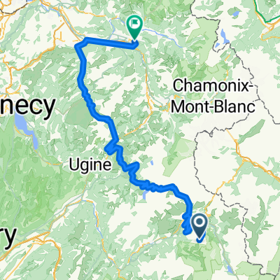
 Col de l'Iseran
- Distance
- 76.5 km
- Ascent
- 1,977 m
- Descent
- 1,473 m
- Location
- Séez, Auvergne-Rhône-Alpes, France
 Annemasse - Arc 2000
- Distance
- 179.2 km
- Ascent
- 3,155 m
- Descent
- 4,887 m
- Location
- Séez, Auvergne-Rhône-Alpes, France
 Cluses - Arc 2000
- Distance
- 160.9 km
- Ascent
- 2,713 m
- Descent
- 4,471 m
- Location
- Séez, Auvergne-Rhône-Alpes, France
 La Trank's
- Distance
- 4.2 km
- Ascent
- 28 m
- Descent
- 382 m
- Location
- Séez, Auvergne-Rhône-Alpes, France
 45DN - Montgirod & back streets to La Monal bar
- Distance
- 51 km
- Ascent
- 833 m
- Descent
- 1,300 m
- Location
- Séez, Auvergne-Rhône-Alpes, France
 Iseran
- Distance
- 42.6 km
- Ascent
- 2,037 m
- Descent
- 136 m
- Location
- Séez, Auvergne-Rhône-Alpes, France
 Route des Grandes Alpes 2019 - stage 3
- Distance
- 76.1 km
- Ascent
- 2,041 m
- Descent
- 1,443 m
- Location
- Séez, Auvergne-Rhône-Alpes, France
 Briançon - Arc 2000
- Distance
- 203 km
- Ascent
- 3,914 m
- Descent
- 4,894 m
- Location
- Séez, Auvergne-Rhône-Alpes, France
Open it in the app