

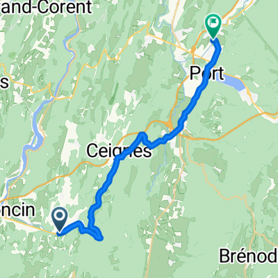
Gorges de l'Ain and Col du Berthiand
A cycling route starting in Poncin, Auvergne-Rhône-Alpes, France.
Overview
About this route
Beautiful ride mainly through the Gorges de l'Ain with a detour to Col de Berthiand (2016 TdF)
- -:--
- Duration
- 74 km
- Distance
- 1,052 m
- Ascent
- 1,052 m
- Descent
- ---
- Avg. speed
- ---
- Max. altitude

Route quality
Waytypes & surfaces along the route
Waytypes
Road
20.7 km
(28 %)
Quiet road
8.1 km
(11 %)
Undefined
45.1 km
(61 %)
Surfaces
Paved
22.9 km
(31 %)
Asphalt
22.9 km
(31 %)
Undefined
51.1 km
(69 %)
Route highlights
Points of interest along the route
Point of interest after 15.7 km
Col du Berthiand
Point of interest after 71.1 km
Col du Hibou
Continue with Bikemap
Use, edit, or download this cycling route
You would like to ride Gorges de l'Ain and Col du Berthiand or customize it for your own trip? Here is what you can do with this Bikemap route:
Free features
- Save this route as favorite or in collections
- Copy & plan your own version of this route
- Sync your route with Garmin or Wahoo
Premium features
Free trial for 3 days, or one-time payment. More about Bikemap Premium.
- Navigate this route on iOS & Android
- Export a GPX / KML file of this route
- Create your custom printout (try it for free)
- Download this route for offline navigation
Discover more Premium features.
Get Bikemap PremiumFrom our community
Other popular routes starting in Poncin
 Stage 7 50 Years CSi
- Distance
- 153.1 km
- Ascent
- 613 m
- Descent
- 649 m
- Location
- Poncin, Auvergne-Rhône-Alpes, France
 Poncin - Bourcia
- Distance
- 43.5 km
- Ascent
- 681 m
- Descent
- 571 m
- Location
- Poncin, Auvergne-Rhône-Alpes, France
 retour partie 2
- Distance
- 21.9 km
- Ascent
- 447 m
- Descent
- 300 m
- Location
- Poncin, Auvergne-Rhône-Alpes, France
 Tav14-04
- Distance
- 134.2 km
- Ascent
- 2,008 m
- Descent
- 2,116 m
- Location
- Poncin, Auvergne-Rhône-Alpes, France
 Gorges de l'Ain and Col du Berthiand
- Distance
- 74 km
- Ascent
- 1,052 m
- Descent
- 1,052 m
- Location
- Poncin, Auvergne-Rhône-Alpes, France
 Bourg-en-Bresse: vallée de l'Ain
- Distance
- 58.7 km
- Ascent
- 783 m
- Descent
- 785 m
- Location
- Poncin, Auvergne-Rhône-Alpes, France
 Poncin - Cernon
- Distance
- 54.6 km
- Ascent
- 811 m
- Descent
- 689 m
- Location
- Poncin, Auvergne-Rhône-Alpes, France
 Poncin - Hieres-sur-Amby
- Distance
- 40.9 km
- Ascent
- 200 m
- Descent
- 246 m
- Location
- Poncin, Auvergne-Rhône-Alpes, France
Open it in the app