

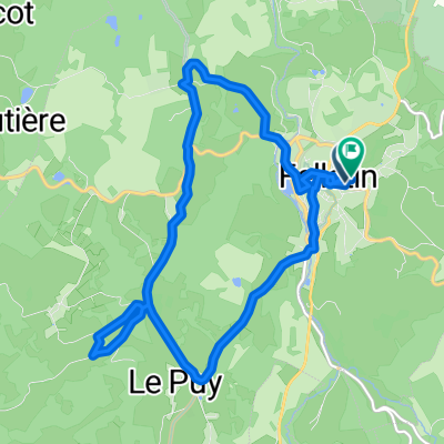
9-sncf-limoges-felletin
A cycling route starting in Felletin, Nouvelle-Aquitaine, France.
Overview
About this route
- -:--
- Duration
- 101.7 km
- Distance
- 746 m
- Ascent
- 984 m
- Descent
- ---
- Avg. speed
- ---
- Max. altitude
Route quality
Waytypes & surfaces along the route
Waytypes
Quiet road
23.4 km
(23 %)
Road
13.2 km
(13 %)
Surfaces
Paved
75.2 km
(74 %)
Unpaved
1 km
(1 %)
Asphalt
75.2 km
(74 %)
Unpaved (undefined)
1 km
(1 %)
Undefined
25.4 km
(25 %)
Continue with Bikemap
Use, edit, or download this cycling route
You would like to ride 9-sncf-limoges-felletin or customize it for your own trip? Here is what you can do with this Bikemap route:
Free features
- Save this route as favorite or in collections
- Copy & plan your own version of this route
- Split it into stages to create a multi-day tour
- Sync your route with Garmin or Wahoo
Premium features
Free trial for 3 days, or one-time payment. More about Bikemap Premium.
- Navigate this route on iOS & Android
- Export a GPX / KML file of this route
- Create your custom printout (try it for free)
- Download this route for offline navigation
Discover more Premium features.
Get Bikemap PremiumFrom our community
Other popular routes starting in Felletin
 Rue de Beaumont, Felletin à Rue de Beaumont, Felletin
- Distance
- 12.7 km
- Ascent
- 296 m
- Descent
- 296 m
- Location
- Felletin, Nouvelle-Aquitaine, France
 Felletin - Fernoël
- Distance
- 31.2 km
- Ascent
- 655 m
- Descent
- 439 m
- Location
- Felletin, Nouvelle-Aquitaine, France
 Felletin - Herment
- Distance
- 42.1 km
- Ascent
- 769 m
- Descent
- 519 m
- Location
- Felletin, Nouvelle-Aquitaine, France
 Crocq to Treignac..
- Distance
- 86.4 km
- Ascent
- 603 m
- Descent
- 856 m
- Location
- Felletin, Nouvelle-Aquitaine, France
 19-felletin
- Distance
- 54.4 km
- Ascent
- 483 m
- Descent
- 591 m
- Location
- Felletin, Nouvelle-Aquitaine, France
 Le Bourg, Saint-Oradoux-près-Crocq à Le Mazendreau, Saint-Oradoux-près-Crocq
- Distance
- 4.2 km
- Ascent
- 65 m
- Descent
- 102 m
- Location
- Felletin, Nouvelle-Aquitaine, France
 Recovered Route
- Distance
- 0.2 km
- Ascent
- 17 m
- Descent
- 13 m
- Location
- Felletin, Nouvelle-Aquitaine, France
 De Route d'Aubusson à Route d'Aubusson
- Distance
- 28 km
- Ascent
- 657 m
- Descent
- 656 m
- Location
- Felletin, Nouvelle-Aquitaine, France
Open it in the app