

ride through Kochi
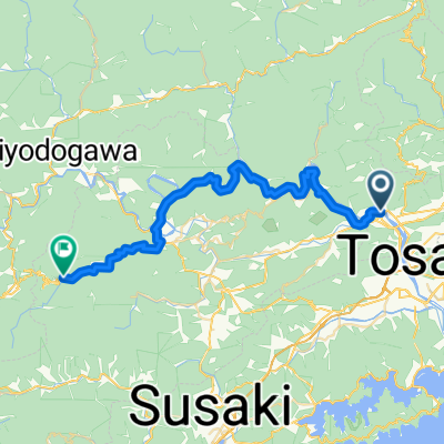
A cycling route starting in Ino, Kochi, Japan.
Overview
About this route
- -:--
- Duration
- 23 km
- Distance
- 1,103 m
- Ascent
- 1,182 m
- Descent
- ---
- Avg. speed
- ---
- Max. altitude
Route photos


Continue with Bikemap
Use, edit, or download this cycling route
You would like to ride ride through Kochi or customize it for your own trip? Here is what you can do with this Bikemap route:
Free features
- Save this route as favorite or in collections
- Copy & plan your own version of this route
- Sync your route with Garmin or Wahoo
Premium features
Free trial for 3 days, or one-time payment. More about Bikemap Premium.
- Navigate this route on iOS & Android
- Export a GPX / KML file of this route
- Create your custom printout (try it for free)
- Download this route for offline navigation
Discover more Premium features.
Get Bikemap PremiumFrom our community
Other popular routes starting in Ino
 Soan
Soan- Distance
- 22.6 km
- Ascent
- 891 m
- Descent
- 893 m
- Location
- Ino, Kochi, Japan
 平和の滝
平和の滝- Distance
- 24.5 km
- Ascent
- 829 m
- Descent
- 829 m
- Location
- Ino, Kochi, Japan
 Kagami Dam - Kitayama - Homura
- Distance
- 19 km
- Ascent
- 669 m
- Descent
- 673 m
- Location
- Ino, Kochi, Japan
 Shingunomori Koen-Amigaws - Kagami Dam - Soan temple
- Distance
- 30.2 km
- Ascent
- 910 m
- Descent
- 910 m
- Location
- Ino, Kochi, Japan
 shikoku ochi- kochi
- Distance
- 38.9 km
- Ascent
- 432 m
- Descent
- 216 m
- Location
- Ino, Kochi, Japan
 Shingunomori - Mitani - Kagami Dam
- Distance
- 34.9 km
- Ascent
- 1,081 m
- Descent
- 1,081 m
- Location
- Ino, Kochi, Japan
 Shingumori-Soanzen-ji
- Distance
- 19.2 km
- Ascent
- 677 m
- Descent
- 678 m
- Location
- Ino, Kochi, Japan
 Kagamiogachi - Redai
- Distance
- 11.4 km
- Ascent
- 569 m
- Descent
- 733 m
- Location
- Ino, Kochi, Japan
Open it in the app