

Pszczyna - Kobiór - Paprocany - Studzienice - Pszczyna 2 maja, 08:19
A cycling route starting in Pszczyna, Silesian Voivodeship, Poland.
Overview
About this route
- 2 h 18 min
- Duration
- 42.8 km
- Distance
- 145 m
- Ascent
- 146 m
- Descent
- 18.6 km/h
- Avg. speed
- ---
- Max. altitude
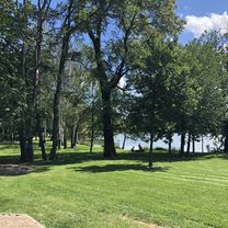
Route photos


Route quality
Waytypes & surfaces along the route
Waytypes
Track
14.6 km
(34 %)
Quiet road
9.4 km
(22 %)
Surfaces
Paved
18.8 km
(44 %)
Unpaved
12.4 km
(29 %)
Asphalt
17.6 km
(41 %)
Gravel
6.9 km
(16 %)
Continue with Bikemap
Use, edit, or download this cycling route
You would like to ride Pszczyna - Kobiór - Paprocany - Studzienice - Pszczyna 2 maja, 08:19 or customize it for your own trip? Here is what you can do with this Bikemap route:
Free features
- Save this route as favorite or in collections
- Copy & plan your own version of this route
- Sync your route with Garmin or Wahoo
Premium features
Free trial for 3 days, or one-time payment. More about Bikemap Premium.
- Navigate this route on iOS & Android
- Export a GPX / KML file of this route
- Create your custom printout (try it for free)
- Download this route for offline navigation
Discover more Premium features.
Get Bikemap PremiumFrom our community
Other popular routes starting in Pszczyna
 Pszczyna - dookoła jeziora Goczałkowickiego
- Distance
- 50 km
- Ascent
- 89 m
- Descent
- 92 m
- Location
- Pszczyna, Silesian Voivodeship, Poland
 Trasa widokowa Goczałkowice
- Distance
- 22.3 km
- Ascent
- 1,199 m
- Descent
- 1,223 m
- Location
- Pszczyna, Silesian Voivodeship, Poland
 Pszczyna-Bielsko-Biała
- Distance
- 29.2 km
- Ascent
- 282 m
- Descent
- 192 m
- Location
- Pszczyna, Silesian Voivodeship, Poland
 Pszczyna-Jawiszowice
- Distance
- 48.8 km
- Ascent
- 134 m
- Descent
- 134 m
- Location
- Pszczyna, Silesian Voivodeship, Poland
 Pszczyna - dookoła jeziora Goczałkowickiego
- Distance
- 46.3 km
- Ascent
- 96 m
- Descent
- 96 m
- Location
- Pszczyna, Silesian Voivodeship, Poland
 Pszczyna - Kobiór - Paprocany - Studzienice - Pszczyna 2 maja, 08:19
- Distance
- 42.8 km
- Ascent
- 145 m
- Descent
- 146 m
- Location
- Pszczyna, Silesian Voivodeship, Poland
 Trasa z Łowiecka, Pszczyna
- Distance
- 18.5 km
- Ascent
- 62 m
- Descent
- 71 m
- Location
- Pszczyna, Silesian Voivodeship, Poland
 Pszczyna-Skoczów
- Distance
- 28.3 km
- Ascent
- 134 m
- Descent
- 88 m
- Location
- Pszczyna, Silesian Voivodeship, Poland
Open it in the app