

Dillstädt-Skihang Schmiedefeld-Schneekopf-Gehlberger Grund-Schneekopf-Zahme Gera-Mönchshof-Mordfleck-Wegscheide (Teil 4)
A cycling route starting in Geraberg, Thuringia, Germany.
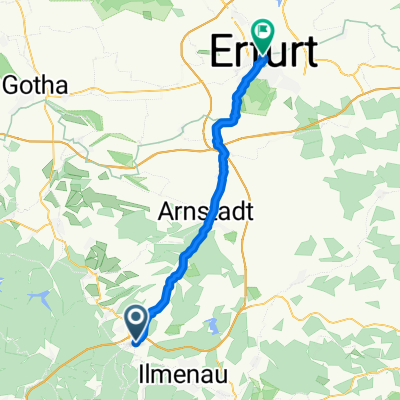
Overview
About this route
the ramp from the Steintal up is just the beginning - then it goes moderately towards the steep ramp with 5 rises, which have about 18% - but fortunately it is a gravel road that is in very good condition - so after 73 hard kilometers, you can still get up relatively easily - at the top then the road towards Schmücke passing by Mönchshof continues, until it turns left onto the Ilm cycling path down into the Freibachtal - this then leisurely up to Mordfleck at the Rennsteig - once more briefly up and then down to Wegscheide - after that it was TIME FOR DESCENT
- -:--
- Duration
- 20.4 km
- Distance
- 667 m
- Ascent
- 312 m
- Descent
- ---
- Avg. speed
- ---
- Max. altitude
Route quality
Waytypes & surfaces along the route
Waytypes
Track
15.7 km
(77 %)
Quiet road
3.1 km
(15 %)
Surfaces
Paved
3.7 km
(18 %)
Unpaved
16.6 km
(81 %)
Gravel
10 km
(49 %)
Ground
5.3 km
(26 %)
Continue with Bikemap
Use, edit, or download this cycling route
You would like to ride Dillstädt-Skihang Schmiedefeld-Schneekopf-Gehlberger Grund-Schneekopf-Zahme Gera-Mönchshof-Mordfleck-Wegscheide (Teil 4) or customize it for your own trip? Here is what you can do with this Bikemap route:
Free features
- Save this route as favorite or in collections
- Copy & plan your own version of this route
- Sync your route with Garmin or Wahoo
Premium features
Free trial for 3 days, or one-time payment. More about Bikemap Premium.
- Navigate this route on iOS & Android
- Export a GPX / KML file of this route
- Create your custom printout (try it for free)
- Download this route for offline navigation
Discover more Premium features.
Get Bikemap PremiumFrom our community
Other popular routes starting in Geraberg
 Geraberg-Steintal-Stützerbach-Ilmenau
- Distance
- 26 km
- Ascent
- 611 m
- Descent
- 494 m
- Location
- Geraberg, Thuringia, Germany
 Jüchnitz/ Mönchhof
- Distance
- 8.3 km
- Ascent
- 557 m
- Descent
- 251 m
- Location
- Geraberg, Thuringia, Germany
 MNG 03 - OBHO - EF
- Distance
- 37.6 km
- Ascent
- 67 m
- Descent
- 292 m
- Location
- Geraberg, Thuringia, Germany
 Jonastal
- Distance
- 43 km
- Ascent
- 454 m
- Descent
- 454 m
- Location
- Geraberg, Thuringia, Germany
 geraberg-wacken über nordhausen
- Distance
- 522.7 km
- Ascent
- 711 m
- Descent
- 1,157 m
- Location
- Geraberg, Thuringia, Germany
 Rennsteig Etappe 2
- Distance
- 108.7 km
- Ascent
- 1,169 m
- Descent
- 1,171 m
- Location
- Geraberg, Thuringia, Germany
 Geraberg - Siegmundsburg
- Distance
- 70.7 km
- Ascent
- 1,220 m
- Descent
- 858 m
- Location
- Geraberg, Thuringia, Germany
 Geraberg-Schorte Ilmenau
- Distance
- 14.2 km
- Ascent
- 639 m
- Descent
- 563 m
- Location
- Geraberg, Thuringia, Germany
Open it in the app