

Nor 4 dzień A i R
A cycling route starting in Brattvåg, Møre og Romsdal, Norway.
Overview
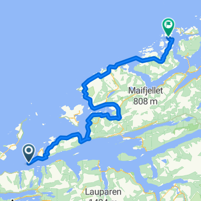
About this route
The route to Sjoholt is quite flat and slightly hilly, only at the end is the climb from 135 to 338 m in elevation.
- -:--
- Duration
- 148.4 km
- Distance
- 712 m
- Ascent
- 449 m
- Descent
- ---
- Avg. speed
- ---
- Max. altitude
Route quality
Waytypes & surfaces along the route
Waytypes
Cycleway
43 km
(29 %)
Quiet road
23.8 km
(16 %)
Surfaces
Paved
63.8 km
(43 %)
Unpaved
1.5 km
(1 %)
Asphalt
63.8 km
(43 %)
Loose gravel
1.5 km
(1 %)
Undefined
83.1 km
(56 %)
Route highlights
Points of interest along the route
Point of interest after 80.1 km
Alesund ładne miasteczko.
Point of interest after 82.9 km
Akwarium oceaniczne.
Point of interest after 86.8 km
Askle punkt widokowy na miasto Alesund.
Point of interest after 108.9 km
Aksla punkt widokowy na Alesund
Point of interest after 128.9 km
Punkt widokowy
Point of interest after 138.6 km
Punkt widokowy
Continue with Bikemap
Use, edit, or download this cycling route
You would like to ride Nor 4 dzień A i R or customize it for your own trip? Here is what you can do with this Bikemap route:
Free features
- Save this route as favorite or in collections
- Copy & plan your own version of this route
- Split it into stages to create a multi-day tour
- Sync your route with Garmin or Wahoo
Premium features
Free trial for 3 days, or one-time payment. More about Bikemap Premium.
- Navigate this route on iOS & Android
- Export a GPX / KML file of this route
- Create your custom printout (try it for free)
- Download this route for offline navigation
Discover more Premium features.
Get Bikemap PremiumFrom our community
Other popular routes starting in Brattvåg
 De Primær Fylkesveg 668 6 à Malmefjordvegen 545
- Distance
- 65.4 km
- Ascent
- 1,438 m
- Descent
- 1,306 m
- Location
- Brattvåg, Møre og Romsdal, Norway
 Day-twentynine-3
- Distance
- 18.7 km
- Ascent
- 289 m
- Descent
- 255 m
- Location
- Brattvåg, Møre og Romsdal, Norway
 2F Midøya - Averøya
- Distance
- 143.8 km
- Ascent
- 1,886 m
- Descent
- 1,882 m
- Location
- Brattvåg, Møre og Romsdal, Norway
 De Ferjevegen 6270 à Hamnsundvegen 7
- Distance
- 18.2 km
- Ascent
- 290 m
- Descent
- 227 m
- Location
- Brattvåg, Møre og Romsdal, Norway
 Nor 4 dzień A i R
- Distance
- 148.4 km
- Ascent
- 712 m
- Descent
- 449 m
- Location
- Brattvåg, Møre og Romsdal, Norway
 Gryta-Fiksdal-Vestrefjord-Gryta
- Distance
- 72.6 km
- Ascent
- 682 m
- Descent
- 681 m
- Location
- Brattvåg, Møre og Romsdal, Norway
 Skjeltene ferjekai nach Primær Fylkesveg 659 7
- Distance
- 19.4 km
- Ascent
- 226 m
- Descent
- 237 m
- Location
- Brattvåg, Møre og Romsdal, Norway
 Itinéraire à partir de Midøyvegen 1359
- Distance
- 31.9 km
- Ascent
- 795 m
- Descent
- 802 m
- Location
- Brattvåg, Møre og Romsdal, Norway
Open it in the app