

Hardt-Dornhan
A cycling route starting in Hardt, Baden-Wurttemberg, Germany.
Overview
About this route
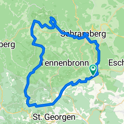
hardt-Sulgen-Aichhalden-Fluorn-Dornhan-Marschalkenzimmern-Hochmössingen-Beffendorf-Bösingen-Dunningen-Eschbronn-Mariazell-Hardt
- -:--
- Duration
- 55.5 km
- Distance
- 338 m
- Ascent
- 335 m
- Descent
- ---
- Avg. speed
- ---
- Max. altitude
Route quality
Waytypes & surfaces along the route
Waytypes
Road
17.5 km
(32 %)
Quiet road
10.9 km
(20 %)
Surfaces
Paved
46.2 km
(83 %)
Unpaved
2.6 km
(5 %)
Asphalt
40.9 km
(74 %)
Paved (undefined)
5.3 km
(10 %)
Continue with Bikemap
Use, edit, or download this cycling route
You would like to ride Hardt-Dornhan or customize it for your own trip? Here is what you can do with this Bikemap route:
Free features
- Save this route as favorite or in collections
- Copy & plan your own version of this route
- Sync your route with Garmin or Wahoo
Premium features
Free trial for 3 days, or one-time payment. More about Bikemap Premium.
- Navigate this route on iOS & Android
- Export a GPX / KML file of this route
- Create your custom printout (try it for free)
- Download this route for offline navigation
Discover more Premium features.
Get Bikemap PremiumFrom our community
Other popular routes starting in Hardt
 KA-ZH Teil-3 Hardt-Bonndorf
- Distance
- 58.9 km
- Ascent
- 541 m
- Descent
- 471 m
- Location
- Hardt, Baden-Wurttemberg, Germany
 Weilerstraße 32, Hardt nach Weilerstraße 30, Hardt
- Distance
- 33.4 km
- Ascent
- 384 m
- Descent
- 367 m
- Location
- Hardt, Baden-Wurttemberg, Germany
 St. Geoergen, Windkapf, Fohrenbühl, Lauterbach, Schramber, Sulgen, Mariazell, Hardt
- Distance
- 49.6 km
- Ascent
- 979 m
- Descent
- 975 m
- Location
- Hardt, Baden-Wurttemberg, Germany
 Entspannende Route in Sankt Georgen im Schwarzwald
- Distance
- 22.8 km
- Ascent
- 510 m
- Descent
- 401 m
- Location
- Hardt, Baden-Wurttemberg, Germany
 Viertälerweg
- Distance
- 62.9 km
- Ascent
- 995 m
- Descent
- 995 m
- Location
- Hardt, Baden-Wurttemberg, Germany
 Windkapf-Route
- Distance
- 48.7 km
- Ascent
- 610 m
- Descent
- 605 m
- Location
- Hardt, Baden-Wurttemberg, Germany
 Rund um Sulgen
- Distance
- 24.6 km
- Ascent
- 253 m
- Descent
- 265 m
- Location
- Hardt, Baden-Wurttemberg, Germany
 Große Fohrenbühl Runde
- Distance
- 47.9 km
- Ascent
- 1,043 m
- Descent
- 1,042 m
- Location
- Hardt, Baden-Wurttemberg, Germany
Open it in the app