

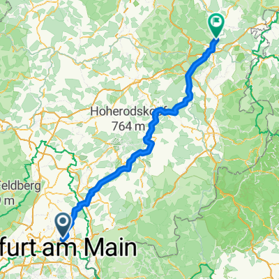
Overview
About this route
- -:--
- Duration
- 141.3 km
- Distance
- 274 m
- Ascent
- 163 m
- Descent
- ---
- Avg. speed
- ---
- Max. altitude

Part of
Fulda - Würzburg -Hanau
3 stages
Route quality
Waytypes & surfaces along the route
Waytypes
Track
39.6 km
(28 %)
Path
35.3 km
(25 %)
Surfaces
Paved
131.4 km
(93 %)
Unpaved
2.8 km
(2 %)
Asphalt
128.6 km
(91 %)
Paved (undefined)
1.4 km
(1 %)
Route highlights
Points of interest along the route
Point of interest after 78.1 km
Lidl
Point of interest after 136.6 km
Lidl
Continue with Bikemap
Use, edit, or download this cycling route
You would like to ride Maintal Rothenfels or customize it for your own trip? Here is what you can do with this Bikemap route:
Free features
- Save this route as favorite or in collections
- Copy & plan your own version of this route
- Split it into stages to create a multi-day tour
- Sync your route with Garmin or Wahoo
Premium features
Free trial for 3 days, or one-time payment. More about Bikemap Premium.
- Navigate this route on iOS & Android
- Export a GPX / KML file of this route
- Create your custom printout (try it for free)
- Download this route for offline navigation
Discover more Premium features.
Get Bikemap PremiumFrom our community
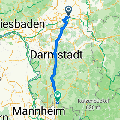
Other popular routes starting in Maintal
 Friedlos-Maintal
- Distance
- 142.1 km
- Ascent
- 1,232 m
- Descent
- 1,122 m
- Location
- Maintal, Hesse, Germany
 PW T2 Fechenheim H.-K.-Park
- Distance
- 19.3 km
- Ascent
- 24 m
- Descent
- 25 m
- Location
- Maintal, Hesse, Germany
 Bergen-Bischofsheim-Riederwald
- Distance
- 23.8 km
- Ascent
- 114 m
- Descent
- 114 m
- Location
- Maintal, Hesse, Germany
 Frankfurter Landstraße nach Am Hauptbahnhof
- Distance
- 85.3 km
- Ascent
- 285 m
- Descent
- 275 m
- Location
- Maintal, Hesse, Germany
 Maintal-Teufelsmühle-Alzenau
- Distance
- 45.7 km
- Ascent
- 385 m
- Descent
- 355 m
- Location
- Maintal, Hesse, Germany
 Maintal Rothenfels
- Distance
- 141.3 km
- Ascent
- 274 m
- Descent
- 163 m
- Location
- Maintal, Hesse, Germany
 PW Maintal Goetheturm Maintal
- Distance
- 34.1 km
- Ascent
- 84 m
- Descent
- 87 m
- Location
- Maintal, Hesse, Germany
 feldberg und brot
- Distance
- 72.5 km
- Ascent
- 955 m
- Descent
- 955 m
- Location
- Maintal, Hesse, Germany
Open it in the app