

Recording from 10:58, May 4
A cycling route starting in Sykia, Central Macedonia, Greece.
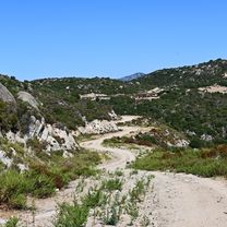
Overview
About this route
thalatta camp-ghost town-melissi-sykia-thalatta camp
- 3 h 5 min
- Duration
- 30 km
- Distance
- 281 m
- Ascent
- 283 m
- Descent
- 9.7 km/h
- Avg. speed
- ---
- Max. altitude

Route quality
Waytypes & surfaces along the route
Waytypes
Quiet road
10.8 km
(36 %)
Road
3.9 km
(13 %)
Surfaces
Paved
12.3 km
(41 %)
Unpaved
4.2 km
(14 %)
Asphalt
10.2 km
(34 %)
Sand
2.4 km
(8 %)
Route highlights
Points of interest along the route

Point of interest after 8.6 km
Continue with Bikemap
Use, edit, or download this cycling route
You would like to ride Recording from 10:58, May 4 or customize it for your own trip? Here is what you can do with this Bikemap route:
Free features
- Save this route as favorite or in collections
- Copy & plan your own version of this route
- Sync your route with Garmin or Wahoo
Premium features
Free trial for 3 days, or one-time payment. More about Bikemap Premium.
- Navigate this route on iOS & Android
- Export a GPX / KML file of this route
- Create your custom printout (try it for free)
- Download this route for offline navigation
Discover more Premium features.
Get Bikemap PremiumFrom our community
Other popular routes starting in Sykia
 Syria - St. Ilias - Sarti - Skala Sykias
- Distance
- 38.5 km
- Ascent
- 768 m
- Descent
- 775 m
- Location
- Sykia, Central Macedonia, Greece
 Sarti-Sykia 8 km
- Distance
- 8 km
- Ascent
- 116 m
- Descent
- 113 m
- Location
- Sykia, Central Macedonia, Greece
 Sykia
Sykia- Distance
- 19.5 km
- Ascent
- 646 m
- Descent
- 970 m
- Location
- Sykia, Central Macedonia, Greece
 Toroni - St. Ilias
- Distance
- 11.4 km
- Ascent
- 409 m
- Descent
- 418 m
- Location
- Sykia, Central Macedonia, Greece
 Kalamitsi - Valti - Tigania - Kriaritsi
- Distance
- 29.9 km
- Ascent
- 455 m
- Descent
- 457 m
- Location
- Sykia, Central Macedonia, Greece
 Kalamitsi - St. Ilias - Sikia
- Distance
- 37 km
- Ascent
- 1,614 m
- Descent
- 1,608 m
- Location
- Sykia, Central Macedonia, Greece
 Torroni 2
- Distance
- 57.9 km
- Ascent
- 821 m
- Descent
- 824 m
- Location
- Sykia, Central Macedonia, Greece
 Sykia - Sarti
- Distance
- 27.4 km
- Ascent
- 669 m
- Descent
- 669 m
- Location
- Sykia, Central Macedonia, Greece
Open it in the app