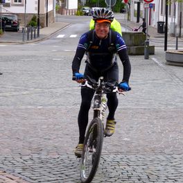
Immekeppeler Runde 18 km
A cycling route starting in Overath, North Rhine-Westphalia, Germany.
Overview
About this route
Start Immekeppel fire station / parking lot > steep climbs and descents on the northern slope towards Großhurden > Leffelsend > Böke > descending horse trail to Klingerath > along L299 on the southern slope 'Lennefer Bach' > steep climb > Brombach > Kalkofen left to the ridge > descent (trail) > along L284 climbs and descents on the SE/E slope to the old railway line > along L284 climb and dynamic descent back to Immekeppel / parking lot - Good luck Schrumpel -
- -:--
- Duration
- 18.1 km
- Distance
- 499 m
- Ascent
- 506 m
- Descent
- ---
- Avg. speed
- ---
- Max. altitude
Continue with Bikemap
Use, edit, or download this cycling route
You would like to ride Immekeppeler Runde 18 km or customize it for your own trip? Here is what you can do with this Bikemap route:
Free features
- Save this route as favorite or in collections
- Copy & plan your own version of this route
- Sync your route with Garmin or Wahoo
Premium features
Free trial for 3 days, or one-time payment. More about Bikemap Premium.
- Navigate this route on iOS & Android
- Export a GPX / KML file of this route
- Create your custom printout (try it for free)
- Download this route for offline navigation
Discover more Premium features.
Get Bikemap PremiumFrom our community
Other popular routes starting in Overath
 Am Wiedenhof 16, Lindlar nach Lindlar Am Lindenbaum
- Distance
- 22.4 km
- Ascent
- 464 m
- Descent
- 462 m
- Location
- Overath, North Rhine-Westphalia, Germany
 Immekeppeler Runde 18 km
- Distance
- 18.1 km
- Ascent
- 499 m
- Descent
- 506 m
- Location
- Overath, North Rhine-Westphalia, Germany
 Schnelle Radrunde durch Lohmar
- Distance
- 3.5 km
- Ascent
- 43 m
- Descent
- 141 m
- Location
- Overath, North Rhine-Westphalia, Germany
 Steinenbrück - Bensberg - Brombach - Steinenbrück
- Distance
- 29.2 km
- Ascent
- 473 m
- Descent
- 485 m
- Location
- Overath, North Rhine-Westphalia, Germany
 Steinenbrück - Gammersbacher Mühle -Runde
- Distance
- 25.8 km
- Ascent
- 368 m
- Descent
- 387 m
- Location
- Overath, North Rhine-Westphalia, Germany
 Talstrasse - Wahn-Heide
- Distance
- 27.9 km
- Ascent
- 556 m
- Descent
- 547 m
- Location
- Overath, North Rhine-Westphalia, Germany
 Rundtour Herkenr. Moitzfeld,Untereschbach
- Distance
- 16.6 km
- Ascent
- 207 m
- Descent
- 216 m
- Location
- Overath, North Rhine-Westphalia, Germany
 Lindlar Schmitzhöhe
- Distance
- 29.7 km
- Ascent
- 419 m
- Descent
- 419 m
- Location
- Overath, North Rhine-Westphalia, Germany
Open it in the app


