14-8-13-Cs-Gaeta-Pantano-LagoVerde-Alcora-ElCastell-LaFoya-Moro-Cs
- 61 km
- 522 m
- 521 m
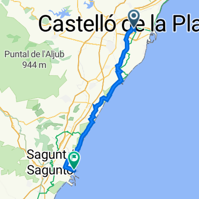
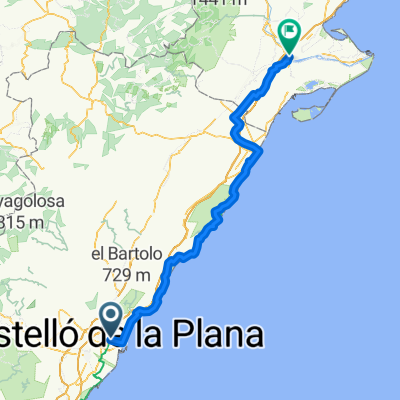
- Castellon, Valencia, Spain
A cycling route starting in Castellon, Valencia, Spain.
Overview
CYCLE TOUR ROUTE FOR THE WHOLE FAMILY.
It takes us to explore the paths of Senillar, an ancient rice plantation area where we can see private initiatives in the construction of chapels dedicated to our patrons.
It also brings us closer to such beautiful places as the Moli de la Fon de la Reina and Sant Francesc de la Font.
The start and return take place along the same stretch of the bank of the Río Seco.
created this 16 years ago
Route quality
Quiet road
10.7 km
(83 %)
Path
1.2 km
(9 %)
Paved
6.6 km
(51 %)
Asphalt
6.4 km
(50 %)
Concrete
0.1 km
(1 %)
Undefined
6.3 km
(49 %)
Continue with Bikemap
You would like to ride Nº 3 SENILLAR - MOLI LA FONT. or customize it for your own trip? Here is what you can do with this Bikemap route:
Free trial for 3 days, or one-time payment. More about Bikemap Premium.
Discover more Premium features.
Get Bikemap PremiumFrom our community
Open it in the app