

Sömmerda-Bad Frankenhausen
- 62.8 km
- 84 m
- 85 m
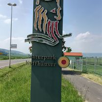
- Sömmerda, Thuringia, Germany
A cycling route starting in Sömmerda, Thuringia, Germany.
Overview
created this 9 years ago


Route quality
Cycleway
22.9 km
(48 %)
Track
11 km
(23 %)
Paved
39.7 km
(83 %)
Unpaved
5.7 km
(12 %)
Asphalt
36.3 km
(76 %)
Loose gravel
3.3 km
(7 %)
Continue with Bikemap
You would like to ride Die schönste Radtour or customize it for your own trip? Here is what you can do with this Bikemap route:
Free trial for 3 days, or one-time payment. More about Bikemap Premium.
Discover more Premium features.
Get Bikemap PremiumFrom our community
Open it in the app


