Gamserberg-Lerchengarten-Voralpsee-Grabser Trail-Alpe Rohr-Götzis
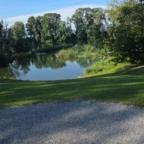
A cycling route starting in Altach, Vorarlberg, Austria.
Overview
About this route
a
- -:--
- Duration
- 98.4 km
- Distance
- 2,341 m
- Ascent
- 2,339 m
- Descent
- ---
- Avg. speed
- ---
- Max. altitude
Route quality
Waytypes & surfaces along the route
Waytypes
Track
39.7 km
(40 %)
Quiet road
26.4 km
(27 %)
Surfaces
Paved
65 km
(66 %)
Unpaved
26 km
(26 %)
Asphalt
60.1 km
(61 %)
Gravel
14.8 km
(15 %)
Continue with Bikemap
Use, edit, or download this cycling route
You would like to ride Gamserberg-Lerchengarten-Voralpsee-Grabser Trail-Alpe Rohr-Götzis or customize it for your own trip? Here is what you can do with this Bikemap route:
Free features
- Save this route as favorite or in collections
- Copy & plan your own version of this route
- Split it into stages to create a multi-day tour
- Sync your route with Garmin or Wahoo
Premium features
Free trial for 3 days, or one-time payment. More about Bikemap Premium.
- Navigate this route on iOS & Android
- Export a GPX / KML file of this route
- Create your custom printout (try it for free)
- Download this route for offline navigation
Discover more Premium features.
Get Bikemap PremiumFrom our community
Other popular routes starting in Altach
- Götzis - Altstätten - Stoß - Appenzell - Eggerstaden - Götzis
- Distance
- 52.4 km
- Ascent
- 746 m
- Descent
- 747 m
- Location
- Altach, Vorarlberg, Austria
- Trainigstour 1 MTB Marathon - 64km - 1534 hm
- Distance
- 66.4 km
- Ascent
- 1,395 m
- Descent
- 1,446 m
- Location
- Altach, Vorarlberg, Austria
- Dornbirner Höhenweg - Buch 60 km - 650hm
- Distance
- 58.9 km
- Ascent
- 466 m
- Descent
- 468 m
- Location
- Altach, Vorarlberg, Austria
- Berkmannweg to Sandholzerstraße
- Distance
- 19.3 km
- Ascent
- 49 m
- Descent
- 100 m
- Location
- Altach, Vorarlberg, Austria
- Sandholzerstraße to Sandholzerstraße
- Distance
- 23.7 km
- Ascent
- 54 m
- Descent
- 103 m
- Location
- Altach, Vorarlberg, Austria
- Trainingsstrecke
- Distance
- 55.7 km
- Ascent
- 1,892 m
- Descent
- 1,892 m
- Location
- Altach, Vorarlberg, Austria
- Altach-Zollikerberg
- Distance
- 140.8 km
- Ascent
- 1,569 m
- Descent
- 1,395 m
- Location
- Altach, Vorarlberg, Austria
- Götzis - Hoher Kasten - Hohe Kugel - Götzis
- Distance
- 86.3 km
- Ascent
- 2,561 m
- Descent
- 2,561 m
- Location
- Altach, Vorarlberg, Austria
Open it in the app