

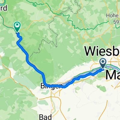
20160505_144752.gpx
A cycling route starting in Budenheim, Rhineland-Palatinate, Germany.
Overview
About this route
TEASI track
- -:--
- Duration
- 36 km
- Distance
- 91 m
- Ascent
- 91 m
- Descent
- ---
- Avg. speed
- ---
- Max. altitude
Route quality
Waytypes & surfaces along the route
Waytypes
Track
22 km
(61 %)
Quiet road
5.8 km
(16 %)
Surfaces
Paved
21.2 km
(59 %)
Unpaved
9.4 km
(26 %)
Asphalt
18.7 km
(52 %)
Gravel
5 km
(14 %)
Continue with Bikemap
Use, edit, or download this cycling route
You would like to ride 20160505_144752.gpx or customize it for your own trip? Here is what you can do with this Bikemap route:
Free features
- Save this route as favorite or in collections
- Copy & plan your own version of this route
- Sync your route with Garmin or Wahoo
Premium features
Free trial for 3 days, or one-time payment. More about Bikemap Premium.
- Navigate this route on iOS & Android
- Export a GPX / KML file of this route
- Create your custom printout (try it for free)
- Download this route for offline navigation
Discover more Premium features.
Get Bikemap PremiumFrom our community
Other popular routes starting in Budenheim
 Crossradrunde durch Rheinhessen
- Distance
- 72.8 km
- Ascent
- 616 m
- Descent
- 565 m
- Location
- Budenheim, Rhineland-Palatinate, Germany
 Mainzer Hinterland
- Distance
- 108.9 km
- Ascent
- 815 m
- Descent
- 817 m
- Location
- Budenheim, Rhineland-Palatinate, Germany
 Am Weisel 10, Mainz nach Am Weisel 2, Mainz
- Distance
- 47.4 km
- Ascent
- 194 m
- Descent
- 199 m
- Location
- Budenheim, Rhineland-Palatinate, Germany
 Budenheim - St.Goar
- Distance
- 51.7 km
- Ascent
- 451 m
- Descent
- 454 m
- Location
- Budenheim, Rhineland-Palatinate, Germany
 Lange Radrunde durch Mainz
- Distance
- 66.9 km
- Ascent
- 277 m
- Descent
- 277 m
- Location
- Budenheim, Rhineland-Palatinate, Germany
 Budenheim - Boppard
- Distance
- 52.3 km
- Ascent
- 458 m
- Descent
- 459 m
- Location
- Budenheim, Rhineland-Palatinate, Germany
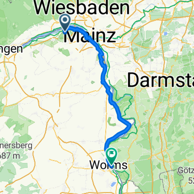 Tour: 1 Waldhotel Mainz, Worms
- Distance
- 67.1 km
- Ascent
- 184 m
- Descent
- 200 m
- Location
- Budenheim, Rhineland-Palatinate, Germany
 Friedrichsstraße 50, Mainz nach Friedrichsstraße 50, Mainz
- Distance
- 17.3 km
- Ascent
- 43 m
- Descent
- 129 m
- Location
- Budenheim, Rhineland-Palatinate, Germany
Open it in the app