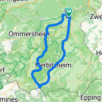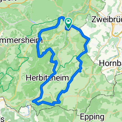
RT 49km Bliestal-Runde
- 48.3 km
- 652 m
- 653 m
- Blieskastel, Saarland, Germany
A cycling route starting in Blieskastel, Saarland, Germany.
Overview
TEASI Track
created this 9 years ago
Route quality
Track
6.1 km
(52 %)
Quiet road
2.6 km
(22 %)
Paved
5.6 km
(48 %)
Unpaved
3.4 km
(29 %)
Asphalt
4 km
(34 %)
Unpaved (undefined)
1.5 km
(13 %)
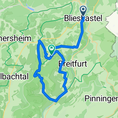
Route highlights
Die Lettkaul liegt hoch über dem kleinen Ort Niederwürzbach am östlichen Rand des Bliesgaus und bietet neben einer Motocrossstrecke und einer kleinen Rennstrecke für Modellautos eine herrliche Aussicht, die den Bliesgau in ganzer Schönheit zeigt.
Der Gollenstein ist ein etwa 4000 Jahre alter Menhir und gilt mit seinen 6,58 Metern Höhe als der größte Menhir Mitteleuropas. Er steht auf dem Blieskasteler Berg nordwestlich des Stadtzentrums und ist das Wahrzeichen der Barockstadt Blieskastel. Fast 4000 Jahre blieb der Gollenstein unversehrt, do
Im Rhododendronpark 'Gut Lindenfels' können in einer Parkanlage von einzigartiger Schönheit Rhododendren in allen Sorten und Farben bewundert werden.
Bergrücken mit phantastischen Ausblicken; abgeschiedene, endlos erscheinende Täler; Stille, die fühlbar scheint und ein 4.000 Jahre alter Monolith – das sind die Zutaten zu einer grandiosen Wanderung jenseits der alltäglichen Hektik. Unterwegs kann noch der Rhododendronpark 'Gut Lindenfels' mit Rho
Continue with Bikemap
You would like to ride Gollenstein Wanderweg or customize it for your own trip? Here is what you can do with this Bikemap route:
Free trial for 3 days, or one-time payment. More about Bikemap Premium.
Discover more Premium features.
Get Bikemap PremiumFrom our community
Open it in the app