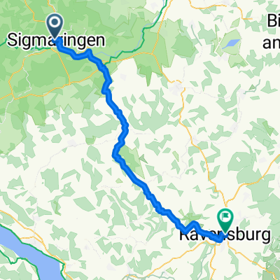
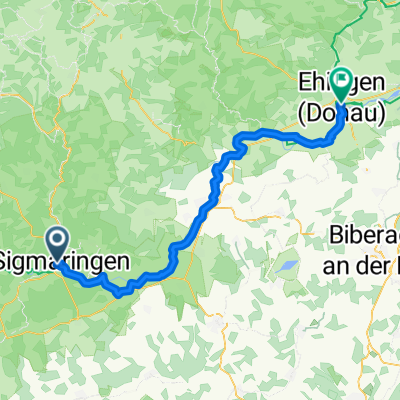
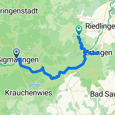
11 Etappe Siegmaringen-Donaueschingen 92 Km 690 hm
A cycling route starting in Sigmaringen, Baden-Wurttemberg, Germany.
Overview
About this route
Siegmaringen, Mühlheim, Tuttlingen, Geisingen, Donaueschingen
- -:--
- Duration
- 90.7 km
- Distance
- 427 m
- Ascent
- 336 m
- Descent
- ---
- Avg. speed
- ---
- Max. altitude
Route quality
Waytypes & surfaces along the route
Waytypes
Track
29.9 km
(33 %)
Path
13.6 km
(15 %)
Surfaces
Paved
74.4 km
(82 %)
Unpaved
12.7 km
(14 %)
Asphalt
68 km
(75 %)
Paved (undefined)
6.3 km
(7 %)
Continue with Bikemap
Use, edit, or download this cycling route
You would like to ride 11 Etappe Siegmaringen-Donaueschingen 92 Km 690 hm or customize it for your own trip? Here is what you can do with this Bikemap route:
Free features
- Save this route as favorite or in collections
- Copy & plan your own version of this route
- Split it into stages to create a multi-day tour
- Sync your route with Garmin or Wahoo
Premium features
Free trial for 3 days, or one-time payment. More about Bikemap Premium.
- Navigate this route on iOS & Android
- Export a GPX / KML file of this route
- Create your custom printout (try it for free)
- Download this route for offline navigation
Discover more Premium features.
Get Bikemap PremiumFrom our community
Other popular routes starting in Sigmaringen
19. Sigmaringen-Riedsee/Donaueschingen (izvor Dunava)- Distance
- 86.6 km
- Ascent
- 1,358 m
- Descent
- 1,256 m
- Location
- Sigmaringen, Baden-Wurttemberg, Germany
Tour 1 - Schmeiental-Tour- Distance
- 19.9 km
- Ascent
- 433 m
- Descent
- 430 m
- Location
- Sigmaringen, Baden-Wurttemberg, Germany
Lange Ausfahrt vom 20. Oktober, 11:25- Distance
- 39.8 km
- Ascent
- 80 m
- Descent
- 122 m
- Location
- Sigmaringen, Baden-Wurttemberg, Germany
Sigmaringen Radfahren- Distance
- 30.8 km
- Ascent
- 178 m
- Descent
- 178 m
- Location
- Sigmaringen, Baden-Wurttemberg, Germany
Tag 2 Sigmaringen nach Riedheim- Distance
- 138 km
- Ascent
- 1,026 m
- Descent
- 1,150 m
- Location
- Sigmaringen, Baden-Wurttemberg, Germany
Donauradweg DE 3- Distance
- 82.6 km
- Ascent
- 277 m
- Descent
- 369 m
- Location
- Sigmaringen, Baden-Wurttemberg, Germany
Winterlingen bis fast Bitz - Laucherttal zurück- Distance
- 49.2 km
- Ascent
- 515 m
- Descent
- 514 m
- Location
- Sigmaringen, Baden-Wurttemberg, Germany
Tour 1 - Schmeiental-Tour- Distance
- 21.6 km
- Ascent
- 375 m
- Descent
- 375 m
- Location
- Sigmaringen, Baden-Wurttemberg, Germany
Open it in the app

