


Reise Innsbruck Blatt2
- 64.8 km
- 680 m
- 472 m
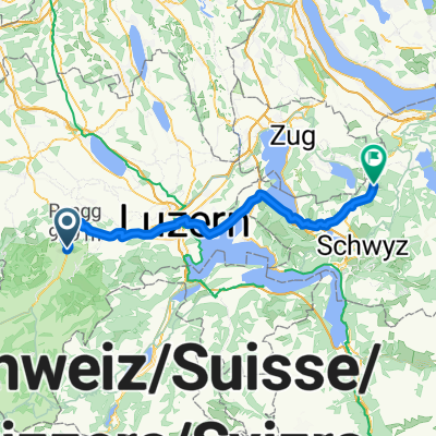
- Entlebuch, Canton of Lucerne, Switzerland
A cycling route starting in Entlebuch, Canton of Lucerne, Switzerland.
Overview
created this 9 years ago
Route quality
Road
12.4 km
(25 %)
Cycleway
10.4 km
(21 %)
Paved
22.8 km
(46 %)
Asphalt
22.3 km
(45 %)
Concrete
0.5 km
(1 %)
Undefined
26.8 km
(54 %)
Continue with Bikemap
You would like to ride Entlebuch-Ettiswil-Entlebuch or customize it for your own trip? Here is what you can do with this Bikemap route:
Free trial for 3 days, or one-time payment. More about Bikemap Premium.
Discover more Premium features.
Get Bikemap PremiumFrom our community
Open it in the app


