Von Moos am Bodensee rund um den Schienerberg
A cycling route starting in Moos, Baden-Württemberg, Germany.
Overview
About this route
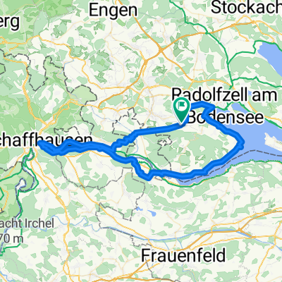
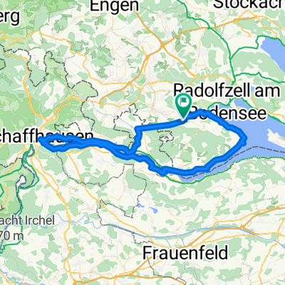
Moos am Bodensee - Ziegelhof - K6160 überqueren - Hittisheim - Wiesholz (CH) - Ramsen (CH) - Wilen (CH) - Bibermühli (CH) - Hemishofen (CH) - Stein am Rhein (CH) - Stiegen - Kattenhorn - Wangen - Hemmenhofen - Gaienhofen - Horn - Iznang - Moos am Bodensee
Primär verläuft die Strecke auf land- oder forstwirtschaftlich genutzten Wegen oder auf dem Bodensee-Radweg, selten wird eine Straße genutzt!
- -:--
- Duration
- 38.6 km
- Distance
- 162 m
- Ascent
- 164 m
- Descent
- ---
- Avg. speed
- ---
- Avg. speed
Route quality
Waytypes & surfaces along the route
Waytypes
Quiet road
19.2 km
(50 %)
Path
6.7 km
(17 %)
Surfaces
Paved
30.3 km
(79 %)
Unpaved
7 km
(18 %)
Asphalt
30.2 km
(78 %)
Gravel
6.4 km
(17 %)
Continue with Bikemap
Use, edit, or download this cycling route
You would like to ride Von Moos am Bodensee rund um den Schienerberg or customize it for your own trip? Here is what you can do with this Bikemap route:
Free features
- Save this route as favorite or in collections
- Copy & plan your own version of this route
- Sync your route with Garmin or Wahoo
Premium features
Free trial for 3 days, or one-time payment. More about Bikemap Premium.
- Navigate this route on iOS & Android
- Export a GPX / KML file of this route
- Create your custom printout (try it for free)
- Download this route for offline navigation
Discover more Premium features.
Get Bikemap PremiumFrom our community
Other popular routes starting in Moos
- 2,5 Hügel-Tour Iznang-Schienen-Gailingen-Iznang
- Distance
- 51.4 km
- Ascent
- 549 m
- Descent
- 549 m
- Location
- Moos, Baden-Württemberg, Germany
- Iznang kaltbrunn
- Distance
- 19.5 km
- Ascent
- 165 m
- Descent
- 135 m
- Location
- Moos, Baden-Württemberg, Germany
- die Grenze ist dicht!
- Distance
- 77.7 km
- Ascent
- 316 m
- Descent
- 315 m
- Location
- Moos, Baden-Württemberg, Germany
- über Buchheim ins Donautal
- Distance
- 142.2 km
- Ascent
- 704 m
- Descent
- 708 m
- Location
- Moos, Baden-Württemberg, Germany
- radolfzell Stein
- Distance
- 40.6 km
- Ascent
- 211 m
- Descent
- 210 m
- Location
- Moos, Baden-Württemberg, Germany
- von Iznang über Radolfzell zur Reichenau
- Distance
- 29.9 km
- Ascent
- 183 m
- Descent
- 190 m
- Location
- Moos, Baden-Württemberg, Germany
- Hegaurunde
- Distance
- 61.2 km
- Ascent
- 185 m
- Descent
- 183 m
- Location
- Moos, Baden-Württemberg, Germany
- Ramsen
- Distance
- 35.4 km
- Ascent
- 152 m
- Descent
- 159 m
- Location
- Moos, Baden-Württemberg, Germany
Open it in the app