

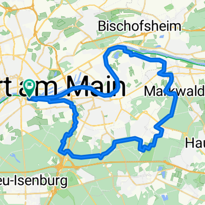
Frankfurt: Hohe Straße - Marköbel - Altenstadt - Florstadt - Niddaradweg
A cycling route starting in Frankfurt am Main, Hesse, Germany.
Overview
About this route
so gefahren am 06.05.2016
- -:--
- Duration
- 86.9 km
- Distance
- 356 m
- Ascent
- 355 m
- Descent
- ---
- Avg. speed
- ---
- Max. altitude
Route quality
Waytypes & surfaces along the route
Waytypes
Track
33.9 km
(39 %)
Quiet road
16.5 km
(19 %)
Surfaces
Paved
80.8 km
(93 %)
Unpaved
1.7 km
(2 %)
Asphalt
79.1 km
(91 %)
Paved (undefined)
0.9 km
(1 %)
Continue with Bikemap
Use, edit, or download this cycling route
You would like to ride Frankfurt: Hohe Straße - Marköbel - Altenstadt - Florstadt - Niddaradweg or customize it for your own trip? Here is what you can do with this Bikemap route:
Free features
- Save this route as favorite or in collections
- Copy & plan your own version of this route
- Split it into stages to create a multi-day tour
- Sync your route with Garmin or Wahoo
Premium features
Free trial for 3 days, or one-time payment. More about Bikemap Premium.
- Navigate this route on iOS & Android
- Export a GPX / KML file of this route
- Create your custom printout (try it for free)
- Download this route for offline navigation
Discover more Premium features.
Get Bikemap PremiumFrom our community
Other popular routes starting in Frankfurt am Main
 MTB FFM Nordend - Hochstadt - Nordend
- Distance
- 29.1 km
- Ascent
- 161 m
- Descent
- 171 m
- Location
- Frankfurt am Main, Hesse, Germany
 Kurze Runde FFM - Höchst vv - Andre
- Distance
- 23.4 km
- Ascent
- 47 m
- Descent
- 47 m
- Location
- Frankfurt am Main, Hesse, Germany
 Junioren BL
- Distance
- 123.7 km
- Ascent
- 1,013 m
- Descent
- 1,013 m
- Location
- Frankfurt am Main, Hesse, Germany
 Ffm-Nordend-Feldbergrunde
- Distance
- 68 km
- Ascent
- 952 m
- Descent
- 934 m
- Location
- Frankfurt am Main, Hesse, Germany
 Flache Flughafenrunde
- Distance
- 49.3 km
- Ascent
- 145 m
- Descent
- 145 m
- Location
- Frankfurt am Main, Hesse, Germany
 Ffm-Nordend-Saalburgrunde
- Distance
- 53.1 km
- Ascent
- 462 m
- Descent
- 445 m
- Location
- Frankfurt am Main, Hesse, Germany
 MTB Dietesheimer Seen
- Distance
- 44 km
- Ascent
- 182 m
- Descent
- 177 m
- Location
- Frankfurt am Main, Hesse, Germany
 Rund um Offenbach
- Distance
- 38.5 km
- Ascent
- 86 m
- Descent
- 88 m
- Location
- Frankfurt am Main, Hesse, Germany
Open it in the app