

Alto del Leon-Cercedilla-Pto. Fuenfría-San Rafael-Collado del Hornillo
A cycling route starting in Los Molinos, Madrid, Spain.
Overview
About this route
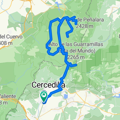
Circular route that can be started from different points. It is tough and aims to connect, from Alto del León, the valley of Cercedilla, Pto. de Fuenfría, the Valley of Espinar, and the access to the valley of Peguerinos from Collado del Hornillo. It closes by the road or track towards Collado de la Mina, below Cabeza Lijar, back to Alto del León, before Puerto de Los Leones.
- -:--
- Duration
- 51.9 km
- Distance
- 1,094 m
- Ascent
- 1,094 m
- Descent
- ---
- Avg. speed
- ---
- Max. altitude

Continue with Bikemap
Use, edit, or download this cycling route
You would like to ride Alto del Leon-Cercedilla-Pto. Fuenfría-San Rafael-Collado del Hornillo or customize it for your own trip? Here is what you can do with this Bikemap route:
Free features
- Save this route as favorite or in collections
- Copy & plan your own version of this route
- Sync your route with Garmin or Wahoo
Premium features
Free trial for 3 days, or one-time payment. More about Bikemap Premium.
- Navigate this route on iOS & Android
- Export a GPX / KML file of this route
- Create your custom printout (try it for free)
- Download this route for offline navigation
Discover more Premium features.
Get Bikemap PremiumFrom our community
Other popular routes starting in Los Molinos
 Cercedilla-Puerto de la Fuenfría-Calle alta
- Distance
- 43 km
- Ascent
- 943 m
- Descent
- 943 m
- Location
- Los Molinos, Madrid, Spain
 Alto del León-Cercedilla-Fuenfria-Gudillos v1
- Distance
- 43 km
- Ascent
- 870 m
- Descent
- 870 m
- Location
- Los Molinos, Madrid, Spain
 Los Molinos Día 2
- Distance
- 171 km
- Ascent
- 3,181 m
- Descent
- 3,182 m
- Location
- Los Molinos, Madrid, Spain
 Alto del Leon-Cercedilla-Pto. Fuenfría-San Rafael-Collado del Hornillo
- Distance
- 51.9 km
- Ascent
- 1,094 m
- Descent
- 1,094 m
- Location
- Los Molinos, Madrid, Spain
 Ruta Sabado
- Distance
- 96.8 km
- Ascent
- 2,783 m
- Descent
- 2,783 m
- Location
- Los Molinos, Madrid, Spain
 Ruta Sabado
- Distance
- 123.2 km
- Ascent
- 2,949 m
- Descent
- 2,963 m
- Location
- Los Molinos, Madrid, Spain
 Ruton PrePiris
- Distance
- 165.2 km
- Ascent
- 3,553 m
- Descent
- 3,554 m
- Location
- Los Molinos, Madrid, Spain
 Ruta Sábado 1
- Distance
- 109.3 km
- Ascent
- 1,868 m
- Descent
- 1,881 m
- Location
- Los Molinos, Madrid, Spain
Open it in the app