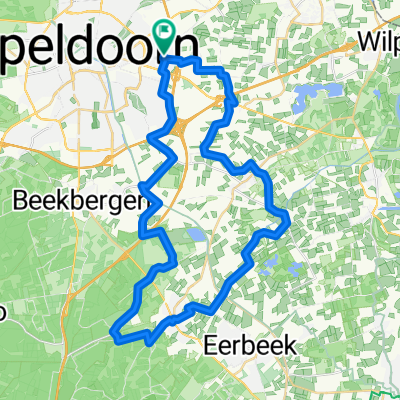
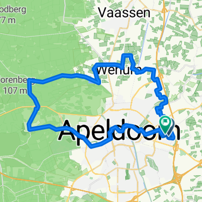
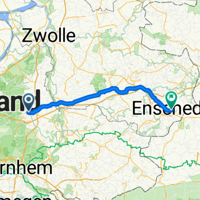
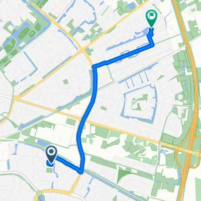
20160504_080743.gpx
A cycling route starting in Apeldoorn, Gelderland, The Netherlands.
Overview
About this route
TEASI track
- -:--
- Duration
- 13.1 km
- Distance
- 72 m
- Ascent
- 72 m
- Descent
- ---
- Avg. speed
- ---
- Max. altitude
Route quality
Waytypes & surfaces along the route
Waytypes
Cycleway
5.7 km
(44 %)
Road
3.8 km
(29 %)
Surfaces
Paved
10.7 km
(82 %)
Unpaved
0.3 km
(2 %)
Asphalt
8.9 km
(68 %)
Concrete
1.8 km
(14 %)
Continue with Bikemap
Use, edit, or download this cycling route
You would like to ride 20160504_080743.gpx or customize it for your own trip? Here is what you can do with this Bikemap route:
Free features
- Save this route as favorite or in collections
- Copy & plan your own version of this route
- Sync your route with Garmin or Wahoo
Premium features
Free trial for 3 days, or one-time payment. More about Bikemap Premium.
- Navigate this route on iOS & Android
- Export a GPX / KML file of this route
- Create your custom printout (try it for free)
- Download this route for offline navigation
Discover more Premium features.
Get Bikemap PremiumFrom our community
Other popular routes starting in Apeldoorn
- hoog soeren
- Distance
- 13.1 km
- Ascent
- 184 m
- Descent
- 179 m
- Location
- Apeldoorn, Gelderland, The Netherlands
- rondje apeldoorn, hoog soeren, radio kootwijk
- Distance
- 29.3 km
- Ascent
- 320 m
- Descent
- 304 m
- Location
- Apeldoorn, Gelderland, The Netherlands
- bos, bos en nog meer bos
- Distance
- 33.7 km
- Ascent
- 342 m
- Descent
- 331 m
- Location
- Apeldoorn, Gelderland, The Netherlands
- rondje radio kootwijk
- Distance
- 29.7 km
- Ascent
- 521 m
- Descent
- 550 m
- Location
- Apeldoorn, Gelderland, The Netherlands
- Elspeet Molen
- Distance
- 37 km
- Ascent
- 156 m
- Descent
- 156 m
- Location
- Apeldoorn, Gelderland, The Netherlands
- Beekbergerwoud
- Distance
- 27.1 km
- Ascent
- 77 m
- Descent
- 76 m
- Location
- Apeldoorn, Gelderland, The Netherlands
- rondje kootwijk
- Distance
- 20.4 km
- Ascent
- 222 m
- Descent
- 239 m
- Location
- Apeldoorn, Gelderland, The Netherlands
- rondje assel, hoog soeren
- Distance
- 17.9 km
- Ascent
- 98 m
- Descent
- 100 m
- Location
- Apeldoorn, Gelderland, The Netherlands
Open it in the app