


A HALMUC 4
- 148 km
- 996 m
- 787 m
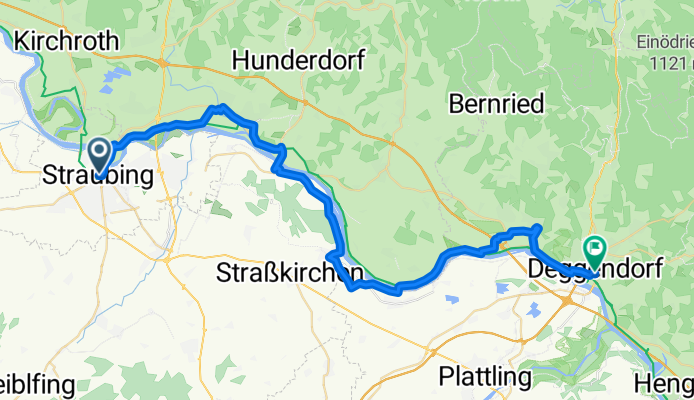
- Straubing, Bavaria, Germany
A cycling route starting in Straubing, Bavaria, Germany.
Overview
Straubing - Deggendorf
created this 9 years ago
Route quality
Track
11.9 km
(26 %)
Road
11.4 km
(25 %)
Paved
29.7 km
(65 %)
Unpaved
10 km
(22 %)
Asphalt
29.2 km
(64 %)
Gravel
5.5 km
(12 %)
Route highlights
templom
Bogen
Bogen templom
Loh
Metten
Continue with Bikemap
You would like to ride 6_Straubing_Deggendorf or customize it for your own trip? Here is what you can do with this Bikemap route:
Free trial for 3 days, or one-time payment. More about Bikemap Premium.
Discover more Premium features.
Get Bikemap PremiumFrom our community
Open it in the app


