

Breulaifa to Montberon
A cycling route starting in Nantiat, Nouvelle-Aquitaine, France.
Overview
About this route
- -:--
- Duration
- 374.8 km
- Distance
- 1,476 m
- Ascent
- 1,561 m
- Descent
- ---
- Avg. speed
- ---
- Max. altitude
Route quality
Waytypes & surfaces along the route
Waytypes
Quiet road
86.2 km
(23 %)
Road
82.5 km
(22 %)
Surfaces
Paved
116.2 km
(31 %)
Unpaved
7.5 km
(2 %)
Asphalt
116.2 km
(31 %)
Gravel
7.5 km
(2 %)
Undefined
251.1 km
(67 %)
Continue with Bikemap
Use, edit, or download this cycling route
You would like to ride Breulaifa to Montberon or customize it for your own trip? Here is what you can do with this Bikemap route:
Free features
- Save this route as favorite or in collections
- Copy & plan your own version of this route
- Split it into stages to create a multi-day tour
- Sync your route with Garmin or Wahoo
Premium features
Free trial for 3 days, or one-time payment. More about Bikemap Premium.
- Navigate this route on iOS & Android
- Export a GPX / KML file of this route
- Create your custom printout (try it for free)
- Download this route for offline navigation
Discover more Premium features.
Get Bikemap PremiumFrom our community
Other popular routes starting in Nantiat
 Breulaifa to Montberon
- Distance
- 374.8 km
- Ascent
- 1,476 m
- Descent
- 1,561 m
- Location
- Nantiat, Nouvelle-Aquitaine, France
 60 Le Mas de l'Or, Saint-Junien-les-Combes à 11 Rue de la Fontaine, Saint-Pardoux-le-Lac
- Distance
- 11.5 km
- Ascent
- 153 m
- Descent
- 79 m
- Location
- Nantiat, Nouvelle-Aquitaine, France
 De Avenue de la Gare 94, Nantiat à Route du Communal-Senon 4, Saint-Gence
- Distance
- 15.2 km
- Ascent
- 176 m
- Descent
- 149 m
- Location
- Nantiat, Nouvelle-Aquitaine, France
 Facile à conduire Saint-Pardoux
- Distance
- 9 km
- Ascent
- 150 m
- Descent
- 103 m
- Location
- Nantiat, Nouvelle-Aquitaine, France
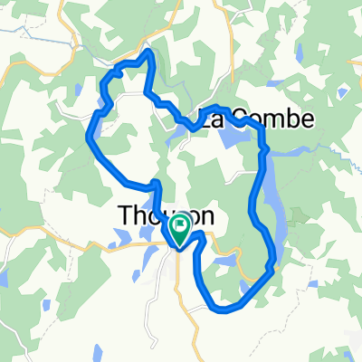 Route de Compreignac, Thouron to Place des Pins, Thouron
- Distance
- 14.8 km
- Ascent
- 727 m
- Descent
- 359 m
- Location
- Nantiat, Nouvelle-Aquitaine, France
 Nantiat Cycling
- Distance
- 109.5 km
- Ascent
- 835 m
- Descent
- 1,040 m
- Location
- Nantiat, Nouvelle-Aquitaine, France
 Impasse des Chênes 6, Vaulry to Impasse des Chênes 6, Vaulry
- Distance
- 4.4 km
- Ascent
- 187 m
- Descent
- 187 m
- Location
- Nantiat, Nouvelle-Aquitaine, France
 2nd leg to Simon's Pierre de Neuvic
- Distance
- 74.3 km
- Ascent
- 699 m
- Descent
- 641 m
- Location
- Nantiat, Nouvelle-Aquitaine, France
Open it in the app