Spich-Holzlar.gpx
A cycling route starting in Wahn-Heide, North Rhine-Westphalia, Germany.
Overview
About this route
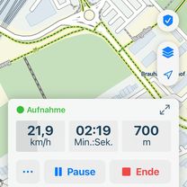
TEASI track return route of the Wahner-Heide (got lost there...)
- -:--
- Duration
- 15.7 km
- Distance
- 61 m
- Ascent
- 24 m
- Descent
- ---
- Avg. speed
- ---
- Max. altitude
Route quality
Waytypes & surfaces along the route
Waytypes
Path
7.5 km
(48 %)
Quiet road
4.2 km
(27 %)
Surfaces
Paved
10.5 km
(67 %)
Asphalt
10.3 km
(66 %)
Paved (undefined)
0.2 km
(1 %)
Undefined
5.2 km
(33 %)
Continue with Bikemap
Use, edit, or download this cycling route
You would like to ride Spich-Holzlar.gpx or customize it for your own trip? Here is what you can do with this Bikemap route:
Free features
- Save this route as favorite or in collections
- Copy & plan your own version of this route
- Sync your route with Garmin or Wahoo
Premium features
Free trial for 3 days, or one-time payment. More about Bikemap Premium.
- Navigate this route on iOS & Android
- Export a GPX / KML file of this route
- Create your custom printout (try it for free)
- Download this route for offline navigation
Discover more Premium features.
Get Bikemap PremiumFrom our community
Other popular routes starting in Wahn-Heide
Rath-Heumar,Bensberg,Forsbach- Distance
- 32 km
- Ascent
- 150 m
- Descent
- 150 m
- Location
- Wahn-Heide, North Rhine-Westphalia, Germany
Flaches Land zw. Rhein und Sieg- Distance
- 42.8 km
- Ascent
- 46 m
- Descent
- 47 m
- Location
- Wahn-Heide, North Rhine-Westphalia, Germany
Flughafen Köln/Bonn - Waldbröl- Distance
- 49.6 km
- Ascent
- 508 m
- Descent
- 236 m
- Location
- Wahn-Heide, North Rhine-Westphalia, Germany
Liburer Landstraße, Köln nach Dahlienweg, Köln- Distance
- 4.4 km
- Ascent
- 3 m
- Descent
- 10 m
- Location
- Wahn-Heide, North Rhine-Westphalia, Germany
Um den Flughafen- Distance
- 33 km
- Ascent
- 160 m
- Descent
- 160 m
- Location
- Wahn-Heide, North Rhine-Westphalia, Germany
Jakobsweg- Distance
- 2,145.4 km
- Ascent
- 3,411 m
- Descent
- 3,218 m
- Location
- Wahn-Heide, North Rhine-Westphalia, Germany
Spich-Holzlar.gpx- Distance
- 15.7 km
- Ascent
- 61 m
- Descent
- 24 m
- Location
- Wahn-Heide, North Rhine-Westphalia, Germany
RTC Köln RTF 2008 150 Km- Distance
- 141.4 km
- Ascent
- 1,030 m
- Descent
- 1,036 m
- Location
- Wahn-Heide, North Rhine-Westphalia, Germany
Open it in the app

