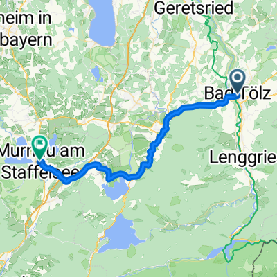
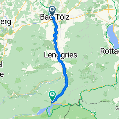
Isarradweg 4 Bad Tölz München
A cycling route starting in Bad Tölz, Bavaria, Germany.
Overview
About this route
- Etappe des Isarradwegs von Bad Tölz nach München
- -:--
- Duration
- 59.8 km
- Distance
- 185 m
- Ascent
- 294 m
- Descent
- ---
- Avg. speed
- ---
- Avg. speed
Route quality
Waytypes & surfaces along the route
Waytypes
Quiet road
23.4 km
(39 %)
Path
16.1 km
(27 %)
Surfaces
Paved
41.4 km
(69 %)
Unpaved
18.2 km
(30 %)
Asphalt
39.7 km
(66 %)
Gravel
11.1 km
(19 %)
Continue with Bikemap
Use, edit, or download this cycling route
You would like to ride Isarradweg 4 Bad Tölz München or customize it for your own trip? Here is what you can do with this Bikemap route:
Free features
- Save this route as favorite or in collections
- Copy & plan your own version of this route
- Sync your route with Garmin or Wahoo
Premium features
Free trial for 3 days, or one-time payment. More about Bikemap Premium.
- Navigate this route on iOS & Android
- Export a GPX / KML file of this route
- Create your custom printout (try it for free)
- Download this route for offline navigation
Discover more Premium features.
Get Bikemap PremiumFrom our community
Other popular routes starting in Bad Tölz
- Kleine Tölzer Kirchsee-Runde
- Distance
- 23.1 km
- Ascent
- 137 m
- Descent
- 137 m
- Location
- Bad Tölz, Bavaria, Germany
- Alpen Cross No 5
- Distance
- 396 km
- Ascent
- 1,671 m
- Descent
- 2,259 m
- Location
- Bad Tölz, Bavaria, Germany
- Bad Tölz - Walchensee - Lenggries
- Distance
- 72.3 km
- Ascent
- 611 m
- Descent
- 611 m
- Location
- Bad Tölz, Bavaria, Germany
- Runde um Brauneck/Benediktenwand
- Distance
- 75.4 km
- Ascent
- 1,416 m
- Descent
- 1,416 m
- Location
- Bad Tölz, Bavaria, Germany
- Blomberg
- Distance
- 27.1 km
- Ascent
- 748 m
- Descent
- 709 m
- Location
- Bad Tölz, Bavaria, Germany
- München - Walchensee - München
- Distance
- 101.2 km
- Ascent
- 1,142 m
- Descent
- 1,081 m
- Location
- Bad Tölz, Bavaria, Germany
- Wengleinstraße 20, Bad Tölz nach Am Bichlerhof 3, Bad Tölz
- Distance
- 31.1 km
- Ascent
- 361 m
- Descent
- 353 m
- Location
- Bad Tölz, Bavaria, Germany
- Eichmühlstraße, Bad Tölz nach Lengries über Felder, Wiesen und Bauernhöfe zurück
- Distance
- 38.4 km
- Ascent
- 690 m
- Descent
- 696 m
- Location
- Bad Tölz, Bavaria, Germany