

C2 Neu-Breisach Rundfahrt
A cycling route starting in Herrlisheim-près-Colmar, Grand Est, France.
Overview
About this route
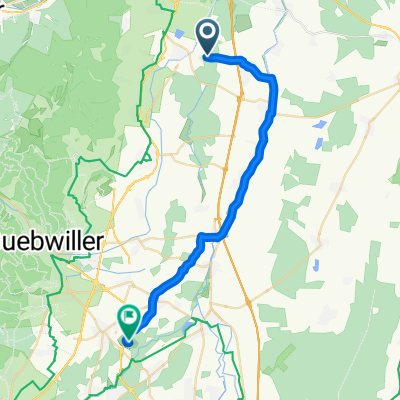
Camp-Hettenschlag-Neu Breisach-(from here the cycle path is signposted) Wolgantzen-Sundhoffen-passing Colmar on the way back
- -:--
- Duration
- 37.7 km
- Distance
- 37 m
- Ascent
- 39 m
- Descent
- ---
- Avg. speed
- ---
- Max. altitude
Route quality
Waytypes & surfaces along the route
Waytypes
Road
13.2 km
(35 %)
Track
12.1 km
(32 %)
Surfaces
Paved
24.9 km
(66 %)
Unpaved
8.3 km
(22 %)
Asphalt
20.7 km
(55 %)
Paved (undefined)
4.1 km
(11 %)
Continue with Bikemap
Use, edit, or download this cycling route
You would like to ride C2 Neu-Breisach Rundfahrt or customize it for your own trip? Here is what you can do with this Bikemap route:
Free features
- Save this route as favorite or in collections
- Copy & plan your own version of this route
- Sync your route with Garmin or Wahoo
Premium features
Free trial for 3 days, or one-time payment. More about Bikemap Premium.
- Navigate this route on iOS & Android
- Export a GPX / KML file of this route
- Create your custom printout (try it for free)
- Download this route for offline navigation
Discover more Premium features.
Get Bikemap PremiumFrom our community
Other popular routes starting in Herrlisheim-près-Colmar
 12 Rue de l'Elsbourg, Herrlisheim-près-Colmar to 11–13 Quai de la Lauch, Issenheim
- Distance
- 19.5 km
- Ascent
- 101 m
- Descent
- 53 m
- Location
- Herrlisheim-près-Colmar, Grand Est, France
 C2 Neu-Breisach Rundfahrt
- Distance
- 37.7 km
- Ascent
- 37 m
- Descent
- 39 m
- Location
- Herrlisheim-près-Colmar, Grand Est, France
 gueberschwir
- Distance
- 29.5 km
- Ascent
- 524 m
- Descent
- 519 m
- Location
- Herrlisheim-près-Colmar, Grand Est, France
 1 Chemin des Peupliers, Herrlisheim-près-Colmar naar 14 Rue Saint-Wendelin, Herrlisheim-près-Colmar
- Distance
- 0.6 km
- Ascent
- 0 m
- Descent
- 0 m
- Location
- Herrlisheim-près-Colmar, Grand Est, France
 C4 Eguisheim - Husseren - Voegtlishofen-Gueberschwir-Pfaffnau-Westhalten-Rouffach-Pfaffheim
- Distance
- 39 km
- Ascent
- 380 m
- Descent
- 380 m
- Location
- Herrlisheim-près-Colmar, Grand Est, France
 suzel -PPrince, Loges v2
- Distance
- 26.2 km
- Ascent
- 132 m
- Descent
- 98 m
- Location
- Herrlisheim-près-Colmar, Grand Est, France
 C3 Camp-Niederhergheim- Oberhergheim-Niederhergerheim-Oberhergerheim-Niederentzen-Meyenheim-Munwiler-Golfplatz
- Distance
- 41.7 km
- Ascent
- 22 m
- Descent
- 22 m
- Location
- Herrlisheim-près-Colmar, Grand Est, France
 Untitled route
- Distance
- 8.7 km
- Ascent
- 25 m
- Descent
- 10 m
- Location
- Herrlisheim-près-Colmar, Grand Est, France
Open it in the app