КОК - АСАН - ЮЖНОБЕРЕЖЬЕ
A cycling route starting in Bilohirsk, Autonomous Republic of Crimea, Ukraine.
Overview
About this route
КОК - АСАН - ЮЖНОБЕРЕЖЬЕ
- -:--
- Duration
- 112.6 km
- Distance
- 1,502 m
- Ascent
- 1,430 m
- Descent
- ---
- Avg. speed
- ---
- Max. altitude
Route highlights
Points of interest along the route
Point of interest after 22.7 km
родник Котла
Continue with Bikemap
Use, edit, or download this cycling route
You would like to ride КОК - АСАН - ЮЖНОБЕРЕЖЬЕ or customize it for your own trip? Here is what you can do with this Bikemap route:
Free features
- Save this route as favorite or in collections
- Copy & plan your own version of this route
- Split it into stages to create a multi-day tour
- Sync your route with Garmin or Wahoo
Premium features
Free trial for 3 days, or one-time payment. More about Bikemap Premium.
- Navigate this route on iOS & Android
- Export a GPX / KML file of this route
- Create your custom printout (try it for free)
- Download this route for offline navigation
Discover more Premium features.
Get Bikemap PremiumFrom our community
Other popular routes starting in Bilohirsk
- belaya skala
- Distance
- 27.2 km
- Ascent
- 279 m
- Descent
- 281 m
- Location
- Bilohirsk, Autonomous Republic of Crimea, Ukraine
- 4 сентября 2016 Белогорск Караби-Яйла Кара-Тау Красноселовка Белогорск
- Distance
- 71.1 km
- Ascent
- 1,018 m
- Descent
- 1,018 m
- Location
- Bilohirsk, Autonomous Republic of Crimea, Ukraine
- ПЕРЕВАЛ БОЛЬШИЕ ВОРОТА - МЕЖГОРЬЕ
- Distance
- 95 km
- Ascent
- 1,190 m
- Descent
- 1,097 m
- Location
- Bilohirsk, Autonomous Republic of Crimea, Ukraine
- БЕЛОГОРСК - СУДАК
- Distance
- 53.6 km
- Ascent
- 1,072 m
- Descent
- 1,198 m
- Location
- Bilohirsk, Autonomous Republic of Crimea, Ukraine
- ride from 21.07.17, 10:03
- Distance
- 25.2 km
- Ascent
- 340 m
- Descent
- 340 m
- Location
- Bilohirsk, Autonomous Republic of Crimea, Ukraine
- НОВОКЛЕНОВО ПЕЩЕРНЫЙ ГОРОД СЕВЕР КАРАБИ
- Distance
- 29.5 km
- Ascent
- 721 m
- Descent
- 720 m
- Location
- Bilohirsk, Autonomous Republic of Crimea, Ukraine
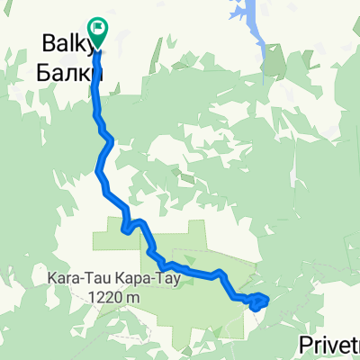
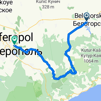
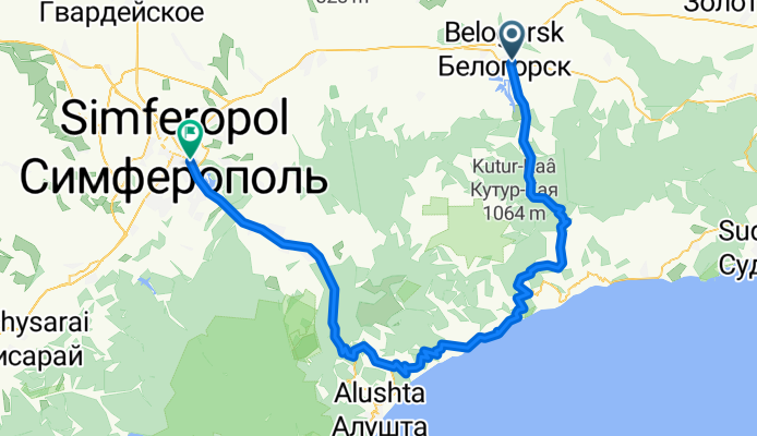
- БЕЛОГОРСК - АРМЯНСКИЙ ХРАМ - "КАНЬОН КУЧУК - КАРАСУ"
- Distance
- 60.2 km
- Ascent
- 603 m
- Descent
- 607 m
- Location
- Bilohirsk, Autonomous Republic of Crimea, Ukraine
- КОК - АСАН - ЮЖНОБЕРЕЖЬЕ
- Distance
- 112.6 km
- Ascent
- 1,502 m
- Descent
- 1,430 m
- Location
- Bilohirsk, Autonomous Republic of Crimea, Ukraine
Open it in the app