

C6 (Def) Sigoldsheim-Kientzheim-Bennwihr-Mittelwihr-Riquewihr-Zellenberg
A cycling route starting in Sigolsheim, Grand Est, France.
Overview
About this route
Planned C6 from Türckheim-Winorte-Sélestat and back the other side would be around 60 km and is okay, but sightseeing and 'Obsi' means too many km.
- -:--
- Duration
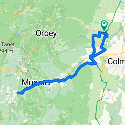
- 23.7 km
- Distance
- 237 m
- Ascent
- 238 m
- Descent
- ---
- Avg. speed
- ---
- Max. altitude
Route quality
Waytypes & surfaces along the route
Waytypes
Quiet road
12.3 km
(52 %)
Track
5.7 km
(24 %)
Surfaces
Paved
15.8 km
(67 %)
Unpaved
0.5 km
(2 %)
Asphalt
8 km
(34 %)
Paved (undefined)
7.8 km
(33 %)
Continue with Bikemap
Use, edit, or download this cycling route
You would like to ride C6 (Def) Sigoldsheim-Kientzheim-Bennwihr-Mittelwihr-Riquewihr-Zellenberg or customize it for your own trip? Here is what you can do with this Bikemap route:
Free features
- Save this route as favorite or in collections
- Copy & plan your own version of this route
- Sync your route with Garmin or Wahoo
Premium features
Free trial for 3 days, or one-time payment. More about Bikemap Premium.
- Navigate this route on iOS & Android
- Export a GPX / KML file of this route
- Create your custom printout (try it for free)
- Download this route for offline navigation
Discover more Premium features.
Get Bikemap PremiumFrom our community
Other popular routes starting in Sigolsheim
 C6 (Def) Sigoldsheim-Kientzheim-Bennwihr-Mittelwihr-Riquewihr-Zellenberg
- Distance
- 23.7 km
- Ascent
- 237 m
- Descent
- 238 m
- Location
- Sigolsheim, Grand Est, France
 Vosges#6
- Distance
- 174.2 km
- Ascent
- 2,661 m
- Descent
- 2,661 m
- Location
- Sigolsheim, Grand Est, France
 Kientzheim - Ribeauvillé - Aubure
- Distance
- 41.7 km
- Ascent
- 819 m
- Descent
- 818 m
- Location
- Sigolsheim, Grand Est, France
 Route des Cretes Teil1 VarianteB
- Distance
- 53.9 km
- Ascent
- 1,316 m
- Descent
- 322 m
- Location
- Sigolsheim, Grand Est, France
 C6 (Def) Sigoldsheim-Kientzheim-Bennwihr-Mittelwihr-Riquewihr-Zellenberg
- Distance
- 24.4 km
- Ascent
- 238 m
- Descent
- 240 m
- Location
- Sigolsheim, Grand Est, France
 De Rue du Stade 8a à Rue du Stade 8a
- Distance
- 63.9 km
- Ascent
- 502 m
- Descent
- 539 m
- Location
- Sigolsheim, Grand Est, France
 KIENTZHEIM ST HIPPOLYTE PAR LES VIGNES
- Distance
- 17.5 km
- Ascent
- 298 m
- Descent
- 278 m
- Location
- Sigolsheim, Grand Est, France
 Route des Cretes Teil1 VarianteA
- Distance
- 52.1 km
- Ascent
- 1,342 m
- Descent
- 348 m
- Location
- Sigolsheim, Grand Est, France
Open it in the app