

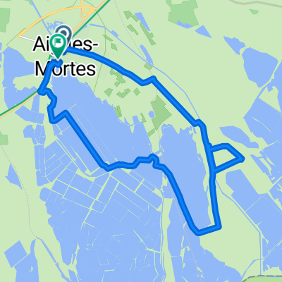
aigues mortes CHENE
A cycling route starting in Aigues-Mortes, Occitanie, France.
Overview
About this route
aigues mortes
- -:--
- Duration
- 529.6 km
- Distance
- 1,578 m
- Ascent
- 1,058 m
- Descent
- ---
- Avg. speed
- ---
- Max. altitude
Route quality
Waytypes & surfaces along the route
Waytypes
Road
158.9 km
(30 %)
Quiet road
158.9 km
(30 %)
Surfaces
Paved
275.4 km
(52 %)
Unpaved
37.1 km
(7 %)
Asphalt
264.8 km
(50 %)
Gravel
26.5 km
(5 %)
Route highlights
Points of interest along the route
Point of interest after 56.4 km
CAMPING DE LA BRISE
Point of interest after 111.2 km
camping city
Continue with Bikemap
Use, edit, or download this cycling route
You would like to ride aigues mortes CHENE or customize it for your own trip? Here is what you can do with this Bikemap route:
Free features
- Save this route as favorite or in collections
- Copy & plan your own version of this route
- Split it into stages to create a multi-day tour
- Sync your route with Garmin or Wahoo
Premium features
Free trial for 3 days, or one-time payment. More about Bikemap Premium.
- Navigate this route on iOS & Android
- Export a GPX / KML file of this route
- Create your custom printout (try it for free)
- Download this route for offline navigation
Discover more Premium features.
Get Bikemap PremiumFrom our community
Other popular routes starting in Aigues-Mortes
 Activity - 22: ViaRhôna de Aigues-Mortes à Palavas-les-Flots
- Distance
- 34.8 km
- Ascent
- 36 m
- Descent
- 37 m
- Location
- Aigues-Mortes, Occitanie, France
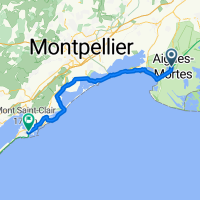 Aigues-Mortes - Sète
- Distance
- 61.8 km
- Ascent
- 108 m
- Descent
- 97 m
- Location
- Aigues-Mortes, Occitanie, France
 From Aigues-Mortes to Vallabrègues
- Distance
- 74.1 km
- Ascent
- 61 m
- Descent
- 51 m
- Location
- Aigues-Mortes, Occitanie, France
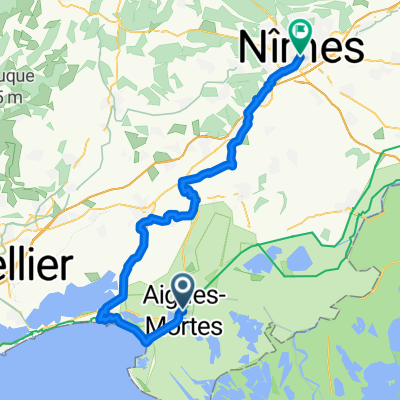 From Aigues-Mortes to Nîmes
- Distance
- 66.6 km
- Ascent
- 140 m
- Descent
- 93 m
- Location
- Aigues-Mortes, Occitanie, France
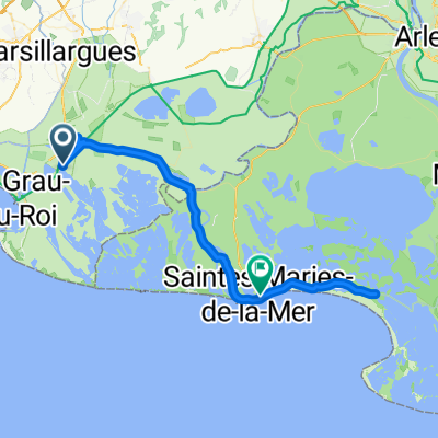 ET2 // Aigues-Mortes - Saintes-Maries-de-la-Mer
- Distance
- 59 km
- Ascent
- 41 m
- Descent
- 43 m
- Location
- Aigues-Mortes, Occitanie, France
 Aigues-Mortes to City camping Arles
- Distance
- 51.9 km
- Ascent
- 440 m
- Descent
- 484 m
- Location
- Aigues-Mortes, Occitanie, France
 l' espiguette
- Distance
- 22 km
- Ascent
- 12 m
- Descent
- 14 m
- Location
- Aigues-Mortes, Occitanie, France
 Aigues-Mortes - Avignon
- Distance
- 86.1 km
- Ascent
- 267 m
- Descent
- 248 m
- Location
- Aigues-Mortes, Occitanie, France
Open it in the app