

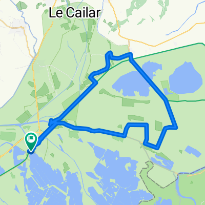
aigues mortes CHENE
A cycling route starting in Aigues-Mortes, Languedoc-Roussillon-Midi-Pyrénées, France.
Overview
About this route
aigues mortes
- -:--
- Duration
- 529.6 km
- Distance
- 1,578 m
- Ascent
- 1,058 m
- Descent
- ---
- Avg. speed
- ---
- Avg. speed
Route quality
Waytypes & surfaces along the route
Waytypes
Quiet road
167.1 km
(32 %)
Road
151.6 km
(29 %)
Surfaces
Paved
269.3 km
(51 %)
Unpaved
29.9 km
(6 %)
Asphalt
261.9 km
(49 %)
Gravel
19.6 km
(4 %)
Route highlights
Points of interest along the route
Point of interest after 56.4 km
CAMPING DE LA BRISE
Point of interest after 111.2 km
camping city
Continue with Bikemap
Use, edit, or download this cycling route
You would like to ride aigues mortes CHENE or customize it for your own trip? Here is what you can do with this Bikemap route:
Free features
- Save this route as favorite or in collections
- Copy & plan your own version of this route
- Sync your route with Garmin or Wahoo
Premium features
Free trial for 3 days, or one-time payment. More about Bikemap Premium.
- Navigate this route on iOS & Android
- Export a GPX / KML file of this route
- Create your custom printout (try it for free)
- Download this route for offline navigation
Discover more Premium features.
Get Bikemap PremiumFrom our community
Other popular routes starting in Aigues-Mortes
 aigues mortes CHENE
- Distance
- 529.6 km
- Ascent
- 1,578 m
- Descent
- 1,058 m
- Location
- Aigues-Mortes, Languedoc-Roussillon-Midi-Pyrénées, France
 Rue Victor Hugo 1 Bis, Aigues-Mortes nach D38, Saintes-Maries-de-la-Mer
- Distance
- 53.5 km
- Ascent
- 18 m
- Descent
- 24 m
- Location
- Aigues-Mortes, Languedoc-Roussillon-Midi-Pyrénées, France
 253 Avenue du Pont de Provence, Aigues-Mortes to 35 Boulevard Gambetta, Aigues-Mortes
- Distance
- 38.5 km
- Ascent
- 284 m
- Descent
- 286 m
- Location
- Aigues-Mortes, Languedoc-Roussillon-Midi-Pyrénées, France
 Itinéraire vers 14 Rue de la Rotonde, Le Grau-du-Roi
- Distance
- 18.6 km
- Ascent
- 5 m
- Descent
- 0 m
- Location
- Aigues-Mortes, Languedoc-Roussillon-Midi-Pyrénées, France
 From Aigues-Mortes to Vallabrègues
- Distance
- 74.1 km
- Ascent
- 61 m
- Descent
- 51 m
- Location
- Aigues-Mortes, Languedoc-Roussillon-Midi-Pyrénées, France
 4 Aigues Mortes - Stes Mries de la Mer
- Distance
- 30.7 km
- Ascent
- 5 m
- Descent
- 9 m
- Location
- Aigues-Mortes, Languedoc-Roussillon-Midi-Pyrénées, France
 aigues mortes monique et gérard le grau du roi
- Distance
- 9.4 km
- Ascent
- 12 m
- Descent
- 13 m
- Location
- Aigues-Mortes, Languedoc-Roussillon-Midi-Pyrénées, France
 BALADE AIGUES MORTES-CODEP GALLICIAN
- Distance
- 43.1 km
- Ascent
- 14 m
- Descent
- 14 m
- Location
- Aigues-Mortes, Languedoc-Roussillon-Midi-Pyrénées, France
Open it in the app