

Ete 2016 (PROJET)
A cycling route starting in Chevry, Auvergne-Rhône-Alpes, France.
Overview
About this route
Traversée de la Suisse de Genève au Val Müstair.
Tour dans les Dolomites
Retour par Innsbruck et Munich (pour retour en train)
- -:--
- Duration
- 1,197.2 km
- Distance
- 10,715 m
- Ascent
- 10,737 m
- Descent
- ---
- Avg. speed
- ---
- Max. altitude

Route quality
Waytypes & surfaces along the route
Waytypes
Busy road
378.7 km
(32 %)
Quiet road
240.1 km
(20 %)
Surfaces
Paved
879.8 km
(73 %)
Unpaved
127.3 km
(11 %)
Asphalt
845.8 km
(71 %)
Gravel
79.1 km
(7 %)
Route highlights
Points of interest along the route
Point of interest after 79.8 km
Lavaux, vignoble UNESCO
Point of interest after 102 km
Château de Chillon
Point of interest after 299.2 km
Furkapass (2436m)
Point of interest after 330.8 km
Oberalppass (2044m)
Point of interest after 466.1 km
Albulapass (2312m)
Point of interest after 518.1 km
Pass dal Fuorn (2149m)
Point of interest after 534 km
Val Müstair, abbaye
Point of interest after 545.9 km
Pass Umbrail (2500m)
Point of interest after 548.8 km
Passo dello Stelvio (2758m)
Point of interest after 592.7 km
Passo du Gavia (2618m)
Point of interest after 616.7 km
Passo Tonale (1883m)
Point of interest after 689 km
Passo della Mendola (1363m)
Point of interest after 712.1 km
Bolzano
Point of interest after 721.1 km
Brennerpass (1370m)
Point of interest after 742 km
Paso Nigra (1688m)
Point of interest after 749.2 km
Passo di Costalunga (1751m)
Point of interest after 778.1 km
Passo del Sella (2244m)
Point of interest after 787.9 km
Passo Gardena (2121m)
Point of interest after 803.2 km
Passo di Campolongo (1876m)
Point of interest after 835 km
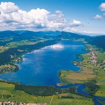
Dolomites
Point of interest after 837.9 km
Passo Giau (2232m)
Point of interest after 859.4 km
Passo Tre Croci (1804m)
Point of interest after 989 km
Hochtor
Point of interest after 1,163.8 km
Innsbruck
Continue with Bikemap
Use, edit, or download this cycling route
You would like to ride Ete 2016 (PROJET) or customize it for your own trip? Here is what you can do with this Bikemap route:
Free features
- Save this route as favorite or in collections
- Copy & plan your own version of this route
- Split it into stages to create a multi-day tour
- Sync your route with Garmin or Wahoo
Premium features
Free trial for 3 days, or one-time payment. More about Bikemap Premium.
- Navigate this route on iOS & Android
- Export a GPX / KML file of this route
- Create your custom printout (try it for free)
- Download this route for offline navigation
Discover more Premium features.
Get Bikemap PremiumFrom our community
Other popular routes starting in Chevry
 Chevry à Petit Lancy #2
- Distance
- 16.8 km
- Ascent
- 109 m
- Descent
- 185 m
- Location
- Chevry, Auvergne-Rhône-Alpes, France
 Crozet, Col du Marchairuz
- Distance
- 109.4 km
- Ascent
- 1,343 m
- Descent
- 1,343 m
- Location
- Chevry, Auvergne-Rhône-Alpes, France
 Short morning ride
- Distance
- 43.4 km
- Ascent
- 182 m
- Descent
- 181 m
- Location
- Chevry, Auvergne-Rhône-Alpes, France
 Mollendruz, Vallée de Joux
- Distance
- 141.3 km
- Ascent
- 1,172 m
- Descent
- 1,174 m
- Location
- Chevry, Auvergne-Rhône-Alpes, France
 Val de valserine
- Distance
- 104.8 km
- Ascent
- 1,313 m
- Descent
- 1,313 m
- Location
- Chevry, Auvergne-Rhône-Alpes, France
 Chevry à Petit Lancy
- Distance
- 23.6 km
- Ascent
- 141 m
- Descent
- 218 m
- Location
- Chevry, Auvergne-Rhône-Alpes, France
 Ete 2016 (PROJET)
- Distance
- 1,197.2 km
- Ascent
- 10,715 m
- Descent
- 10,737 m
- Location
- Chevry, Auvergne-Rhône-Alpes, France
 Col de Crozet
- Distance
- 24.5 km
- Ascent
- 944 m
- Descent
- 953 m
- Location
- Chevry, Auvergne-Rhône-Alpes, France
Open it in the app