

sese
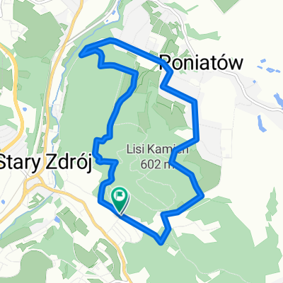
A cycling route starting in Wałbrzych, Lower Silesian Voivodeship, Poland.
Overview
About this route
- -:--
- Duration
- 41.1 km
- Distance
- 426 m
- Ascent
- 349 m
- Descent
- ---
- Avg. speed
- ---
- Max. altitude

Route quality
Waytypes & surfaces along the route
Waytypes
Road
28.4 km
(69 %)
Quiet road
4.1 km
(10 %)
Surfaces
Paved
22.2 km
(54 %)
Asphalt
22.2 km
(54 %)
Undefined
18.9 km
(46 %)
Continue with Bikemap
Use, edit, or download this cycling route
You would like to ride sese or customize it for your own trip? Here is what you can do with this Bikemap route:
Free features
- Save this route as favorite or in collections
- Copy & plan your own version of this route
- Sync your route with Garmin or Wahoo
Premium features
Free trial for 3 days, or one-time payment. More about Bikemap Premium.
- Navigate this route on iOS & Android
- Export a GPX / KML file of this route
- Create your custom printout (try it for free)
- Download this route for offline navigation
Discover more Premium features.
Get Bikemap PremiumFrom our community
Other popular routes starting in Wałbrzych
 Wałbrzych, Trasa wokół Ptasiej Kopy
- Distance
- 7.9 km
- Ascent
- 295 m
- Descent
- 300 m
- Location
- Wałbrzych, Lower Silesian Voivodeship, Poland
 Wałbrzych - Międzylesie przez Czechy rowerem
- Distance
- 383.4 km
- Ascent
- 4,701 m
- Descent
- 4,645 m
- Location
- Wałbrzych, Lower Silesian Voivodeship, Poland
 Wałbrzych - Wielka Sowa
- Distance
- 32.8 km
- Ascent
- 1,073 m
- Descent
- 494 m
- Location
- Wałbrzych, Lower Silesian Voivodeship, Poland
 sieniawka v3
- Distance
- 112.3 km
- Ascent
- 543 m
- Descent
- 540 m
- Location
- Wałbrzych, Lower Silesian Voivodeship, Poland
 2017.03.04 WRW - Wałbrzych do Wałbrzych
- Distance
- 134.3 km
- Ascent
- 1,299 m
- Descent
- 1,299 m
- Location
- Wałbrzych, Lower Silesian Voivodeship, Poland
 Borowa
- Distance
- 21.9 km
- Ascent
- 500 m
- Descent
- 500 m
- Location
- Wałbrzych, Lower Silesian Voivodeship, Poland
 Wałbrzych - Unisław - Jedlina Zdrój
- Distance
- 30.9 km
- Ascent
- 500 m
- Descent
- 498 m
- Location
- Wałbrzych, Lower Silesian Voivodeship, Poland
 Wch-ZalewM-Wch
- Distance
- 100.8 km
- Ascent
- 473 m
- Descent
- 475 m
- Location
- Wałbrzych, Lower Silesian Voivodeship, Poland
Open it in the app