

In de Hockn
A cycling route starting in Gallneukirchen, Upper Austria, Austria.
Overview
About this route
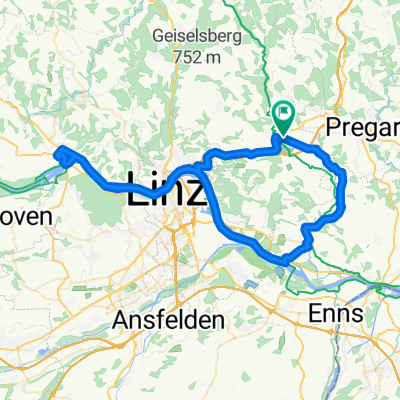
Arbeitsweg mit dem Radl von Treffling nach Traun
- -:--
- Duration
- 26.1 km
- Distance
- 72 m
- Ascent
- 188 m
- Descent
- ---
- Avg. speed
- ---
- Max. altitude

Route quality
Waytypes & surfaces along the route
Waytypes
Quiet road
7 km
(27 %)
Path
5.2 km
(20 %)
Surfaces
Paved
22.5 km
(86 %)
Unpaved
1 km
(4 %)
Asphalt
21.9 km
(84 %)
Paved (undefined)
0.5 km
(2 %)
Continue with Bikemap
Use, edit, or download this cycling route
You would like to ride In de Hockn or customize it for your own trip? Here is what you can do with this Bikemap route:
Free features
- Save this route as favorite or in collections
- Copy & plan your own version of this route
- Sync your route with Garmin or Wahoo
Premium features
Free trial for 3 days, or one-time payment. More about Bikemap Premium.
- Navigate this route on iOS & Android
- Export a GPX / KML file of this route
- Create your custom printout (try it for free)
- Download this route for offline navigation
Discover more Premium features.
Get Bikemap PremiumFrom our community
Other popular routes starting in Gallneukirchen
 Galli Kirchschlag Gis Linz
- Distance
- 58.2 km
- Ascent
- 1,022 m
- Descent
- 1,022 m
- Location
- Gallneukirchen, Upper Austria, Austria
 Gallneukirchen-Steyregg-Gallneukirchen
- Distance
- 37.8 km
- Ascent
- 265 m
- Descent
- 263 m
- Location
- Gallneukirchen, Upper Austria, Austria
 Galli - Pelmberg - Galli
- Distance
- 33.6 km
- Ascent
- 577 m
- Descent
- 577 m
- Location
- Gallneukirchen, Upper Austria, Austria
 Lederergasse 50, Gallneukirchen nach Lederergasse 50, Gallneukirchen
- Distance
- 16.7 km
- Ascent
- 435 m
- Descent
- 427 m
- Location
- Gallneukirchen, Upper Austria, Austria
 MTB Tour durchs Mühlviertel
- Distance
- 23.4 km
- Ascent
- 456 m
- Descent
- 453 m
- Location
- Gallneukirchen, Upper Austria, Austria
 Gallneukirchen - Tschechische Grenze
- Distance
- 63.8 km
- Ascent
- 1,292 m
- Descent
- 1,292 m
- Location
- Gallneukirchen, Upper Austria, Austria
 Gallneukitchen-Abwinden-Ottensheim-Gallneukirchen
- Distance
- 71.3 km
- Ascent
- 193 m
- Descent
- 193 m
- Location
- Gallneukirchen, Upper Austria, Austria
 Gallneukirchen-Schneebergerstüber-Gallneukirchen
- Distance
- 25 km
- Ascent
- 302 m
- Descent
- 302 m
- Location
- Gallneukirchen, Upper Austria, Austria
Open it in the app